7:09 AM
Yes, we Hearty Hikers finally climbed Mt. Fuji.
Some of you out there might be considering it. There’s lots you need to know. Hopefully, this will help a little.
First of all, there are four different trails up the mountain. The Yoshida, Gotemba, Subashiri, and Fujinomiya trails. We chose the Fujinomiya.
For folks with a car, you need to drive to the Mizugatsuka parking lot, about 70 minutes from my house in Shizuoka City, and catch the shuttle bus from there—if you’ve chosen the Fujinomiya Trail. They don’t let you drive your own car up to the trailhead anymore. The shuttle bus takes about 30 minutes. If you don’t have a car, you can get shuttle buses from, Fuji, Gotemba, Shizuoka, Mishima, and Tokyo train stations.
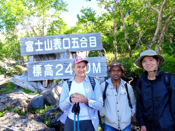
The trailhead. That in itself is a bit confusing. Below you can see us standing at the trailhead, but actually this is the fifth stage of the trail.
8:25 AM
Almost everyone who climbs the Fujinomiya Trail starts from here, 2400 meters in altitude, but you can certainly start at Stage 0 if you like.
I don’t know where Stage 0 is.
Actually, there were four of us Hearty Hikers—but one was taking the picture. We were of four different nationalities. We were of four different nationalities because we were born in four different countries. None of us chose our nationalities. Nationality is, for better or worse, a club that is chosen for you, almost always based on the place you were born, which, unless you have special powers that I don’t, you cannot control.
That being said, Mount Fuji didn’t really seem concerned with our nationality. We weren’t concerned with it, either.
Anyway, there we Hearty Hikers were at Stage 5, the start . . .
 8:28 AM
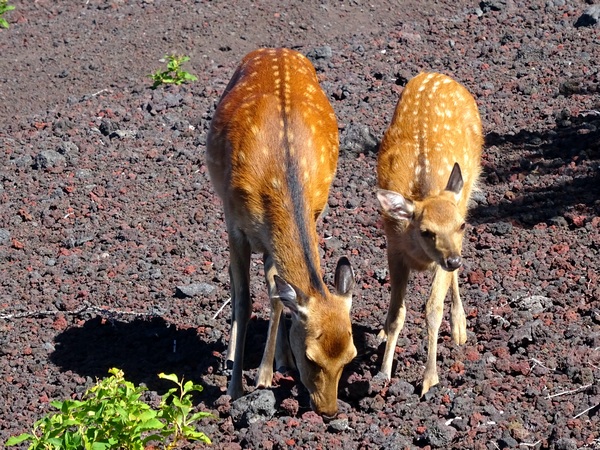
. . . and what a pleasant surprise, the deer came out to greet us. I’m not sure whether they come to greet everyone.
Take a look at the “ground” they are walking, and you will see very clearly that you’re about to head up a volcano—in this case, one that likes to spew every one hundred years or so. The video on the shuttle bus, if you take it, will remind you that it could spew at any time.
Dust, and little bits of lava, and bigger bits of lava, and lava rocks and boulders, this is what you’re going to walk up for the next three to six hours, before you reach the summit at 3,776 meters.
Guidebooks will say it takes five hours to the top. We took a reasonable amount of rest and made it to the top in about four hours. If you climb, the main thing is not to worry about how long it takes you, but to climb while remaining comfortable and stress-free, no longer how long it takes.
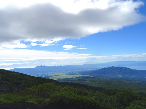
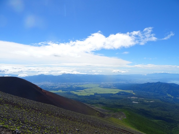
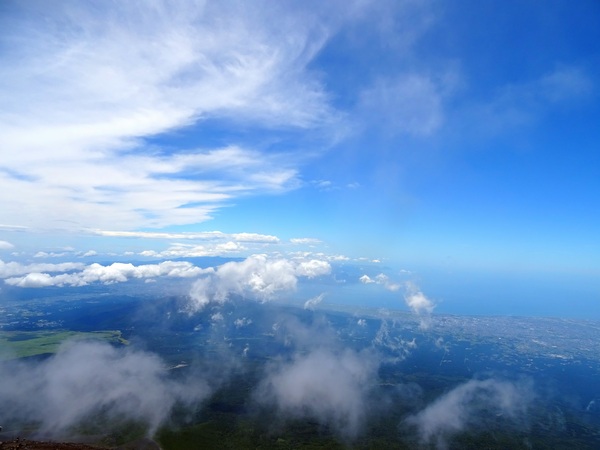
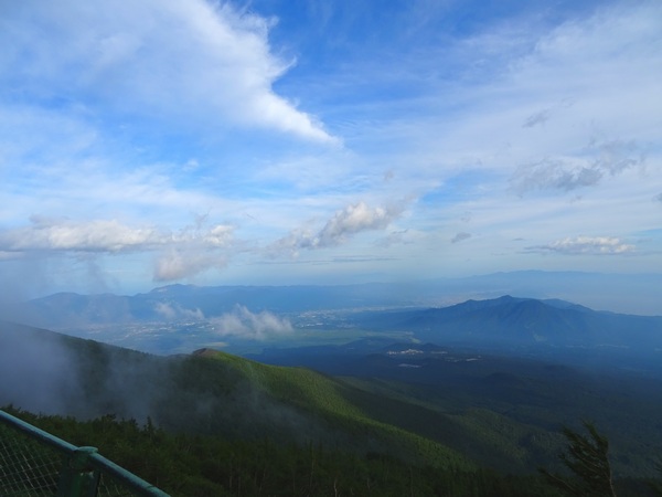
8:33 AM
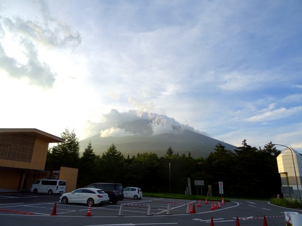
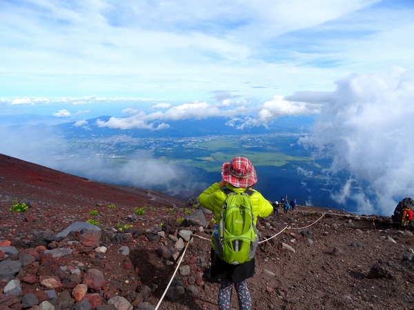
The weather was beautiful on our day up. The above is what the view looks like from slightly above Stage 5.
8:35 AM
Up, up, you go.
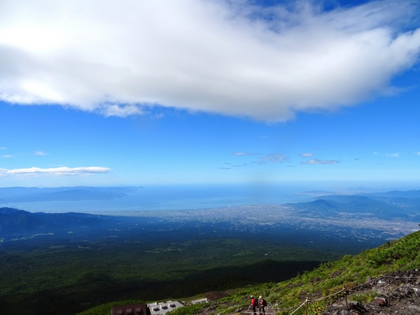
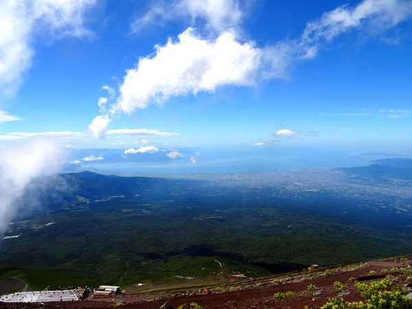
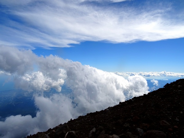
Some folks like to spend the night on top. The skies tend to be clearer in the morning hours, and you might get a spectacular sunrise. I’ve also heard folks say that at night they felt as if they could reach out and sweep up a whole armful of stars.
But no matter when you go, there’s likely to be swirling mist, and you may be in the middle of it for almost the whole hike, or for a good portion of it. We were lucky. We were pretty much enjoying the blue skies and blue bay and the blue peninsula and mountains below, until the last hour or so of the way up.
8:50 AM
8:55 AM
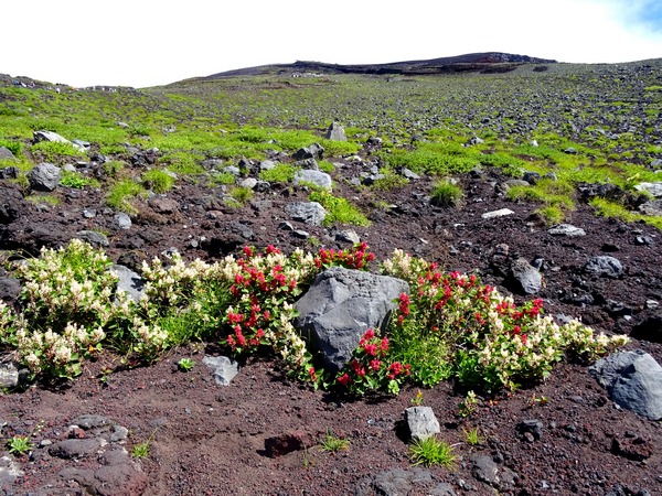
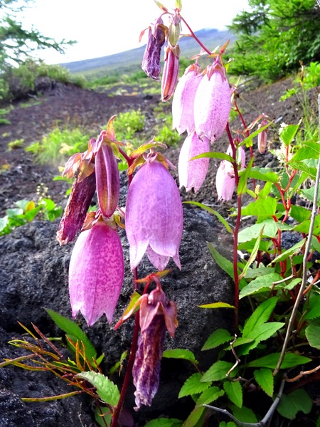
The tree line reaches Stage 5, but above that, you don’t see much growing. Just some clumpy flowers here and there.
9:21 AM
9:25 AM
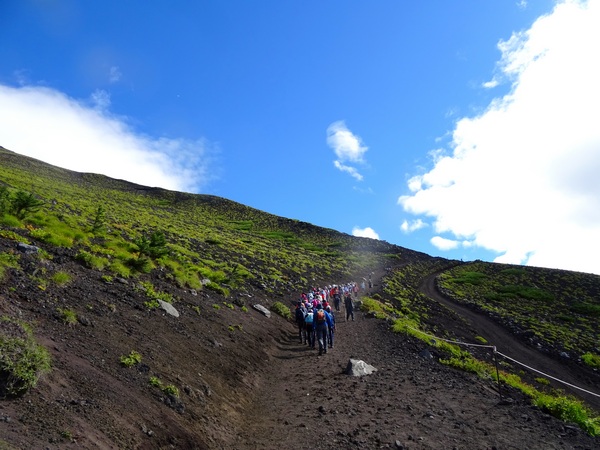
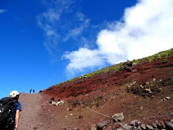
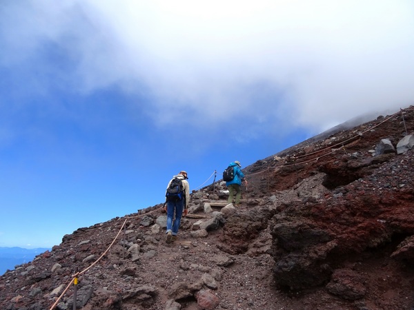
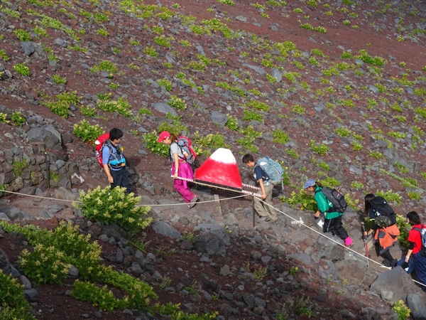
This gives you a bit of an idea of the grade of the slope. The first two-thirds of the way up is something like this. The guy with the helmet is a rescue worker. Not many, but some hikers, also wear helmets. We didn’t see any falling rocks, but fall they surely do from time to time. And then there’s always the possibility of an eruption, though I think they can predict one to some degree.
The rescue worker was actually on his way to rescue an elderly gentlemen who had keeled over. A whole team of rescuers carried him to where they could helicopter him out.
It’s hard seeing someone in trouble and wondering how much you should help. (We asked the first two rescuers on the scene if we could help carry the stretcher, but they said a large team was on the way.)
The video on the shuttle bus reminds you: “Climbing Fuji is not an easy task.” That is perfectly correct. You need to be in shape, you need to be prepared for hot weather, cold weather, and rainy weather, you need to have a plan—so that you don’t overextend yourself—and you need to know the symptoms of altitude sickness, and what to do if you start feeling “a little funny.” The main things you can do to avoid altitude sickness are 1) hang around stage 5 for a while (20 minutes? an hour?) before you start hiking, so that your body can adjust, 2) go slow, 3) take breaks at the hut at each stage up, so your body can keep adjusting, 4) stop and rest any time you feel your heart/lungs stressed more than they usually are when you hike similar grades, 5) be willing to quit if you start to feel bad, and 6) have some canned oxygen with you, just in case.
10:12 AM
10:27 AM
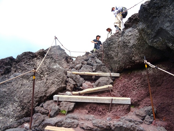
Occasionally, the going get’s “rocky” and a bit steep, but there’s not so much of this.
Much, much, much more of the dusty, pebbly trail.
Another word about altitude sickness. Lots of families come with lots of young kids. That’s fine, if the kids want to climb, and the parents keep a close eye on their conditions. But of the people I saw who seemed to be suffering from altitude sickness, most of them were young kids. If you do take your kid, please don’t push them past what’s safe. They have many, many years to climb Mt. Fuji.
10:44 AM
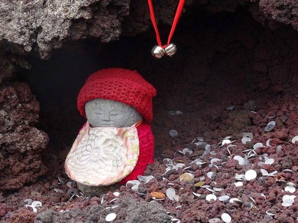
This little fellow seemed to understand the importance of rest.
He is, by the way, a bit of a sacred fellow—for Mt. Fuji is actually a shrine, a sacred place.
And Mt. Fuji is a sacred place, for the most part, because it is attached to this earth, which is in itself a sacred place. And that is because . . . well, you probably know all about exploding stars and star dust, so I’ll skip that.
11:00 AM
Up the Hearty Hikers go.
11:02 AM
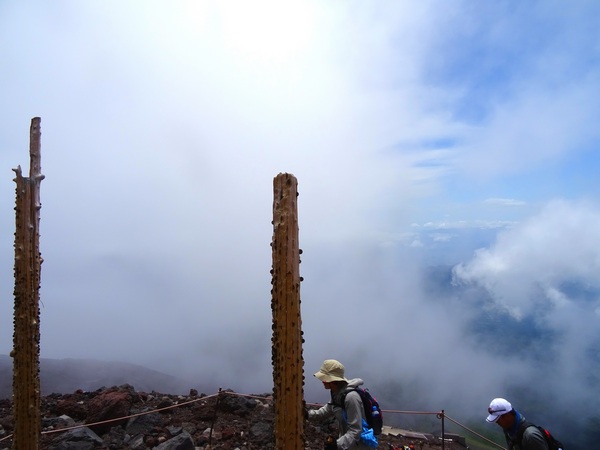
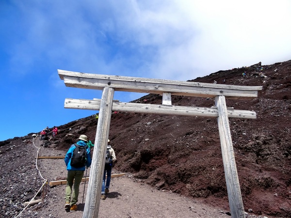
These two “poles” may, at first glance, look like the stumps of two dead trees, but actually they are the remains of a torii gate—a gate that lets you know you’re moving deeper into sacred territory. In the past, there was a crossbeam that rested atop these two poles, and another crossbeam, a tad lower, running between them.
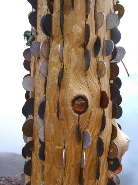
People still like to give small offerings, though. A man standing there as I took this picture told me that there was only one thing that anyone could pray for—and that was for everyone and everything’s well-being.
He is right.
I think.
11:04 AM
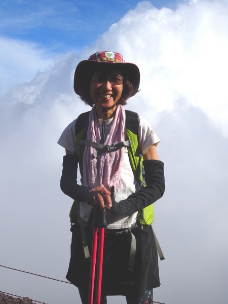
Oh, and here we have the fourth of our Hearty gang—our inspiration.
She was born and bred in Shizuoka. Which is not a country. Just a city. So she can stay or leave as she likes. She likes Shizuoka so she stays.
I like Shizuoka, too.
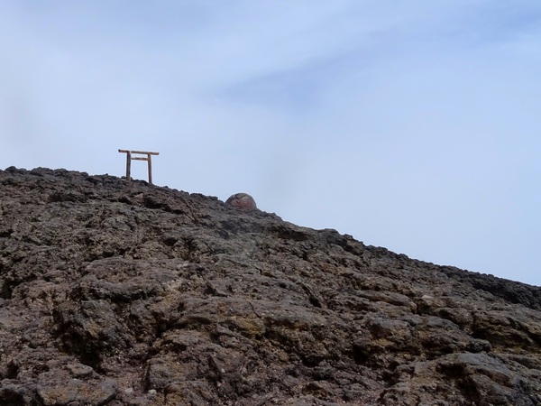
11:21 AM
A torii gate intact.
11:23 AM
Yes.
Then there was the final leg, a bit steeper, and thus, I didn’t take my camera out of my pocket, and then we were up on the top—and in typhoon-like conditions. It had begun to get a bit gusty twenty minutes earlier, but literally, the conditions changed drastically in the last ten meters up to the top. I said “typhoon-like,” but there wasn’t any rain, just mist blowing around like crazy and a lot of volcanic dust-bead bee-bees pelleting us. When it gusted most, it was very difficult to stand.
 12:20-ish, when we first got up to the “top.”
It looked like this, from the front of the shrine, when it wasn’t so gusty.
As a group, we decided to head into the lodge and have some lunch and let our bodies adjust a bit to the thin air.
I wrote “top,” in quotation marks above because we had gotten to the shrine that is up on the top, and we were on the trail that circles the crater, but we were not yet at the highest point. That was another twenty minutes away, and another 40 meters up.
A very, very tough 40 meters.
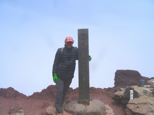
It may not look like I was holding on to the peak marker for dear life . . . but I was.
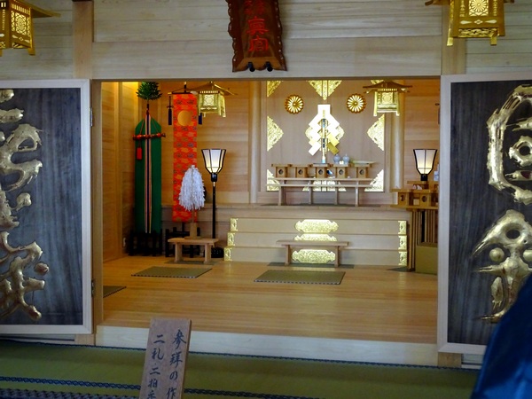
Back down at the shrine and inside, things were suddenly very peaceful.
Of course, we prayed for everyone’s well-being. Everything’s.
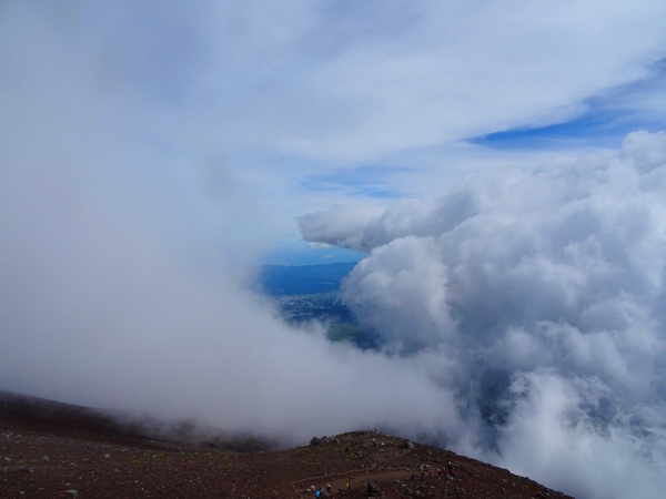
There’s more mist (“GAS,” in Japanese), in the afternoons, and the view tends to get obscured. But this provides the opportunity for suddenly clearing views, which can be delightful.
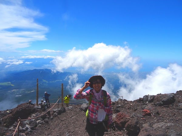
A delighted Hearty Hiker!
In the clouds.
A Hearty Hiker in the clouds.
To be honest, it was a long, tough hike, and the Fuji I climbed was more than enough for me. Some folks, however, don’t seem satisfied with just one Fuji. They brought their own.
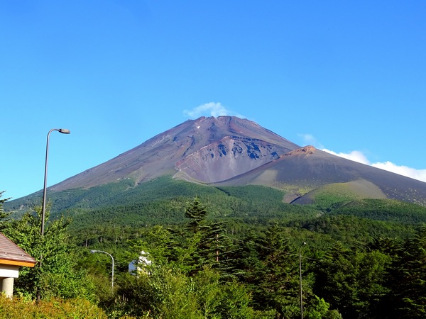
Just like the views? You don’t even have to climb. Just enjoy standing at the railing behind the gift shop at Stage 5.
The deer left these for us. We had prayed for them, too, but I can’t say whether or not that influenced them so quickly.
We made it back to our car around 6 PM.
Maybe we’ll have slightly different feelings for our friend Fuji now, when we look up to her, as we drive and walk the streets of Shizuoka, 70 kilometers away.