 An early August hike/climb up Mt. Tsubakuro. Actually, the first leg of a three-day hike, two nights on the mountain ridge.
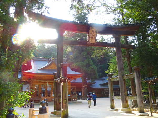
From Shizuoka, it’s about a three-hour drive to Azumino City in Nagano. We parked our car next to Hotaka Shrine, in the lot allotted to hikers, and took an hour bus ride to Nakafusa Hot Springs. I think we caught the bus at about 5 AM.
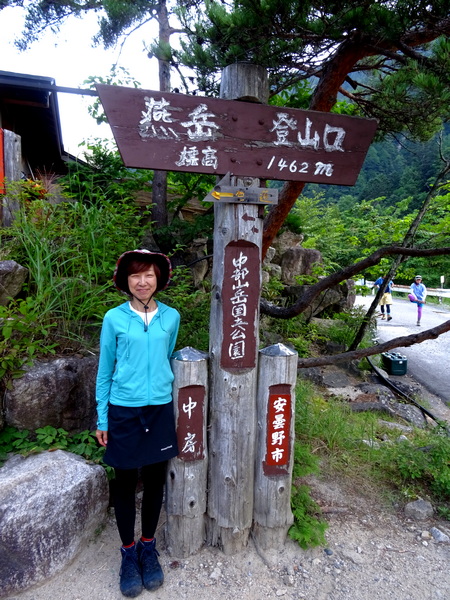
The trailhead up to Mt. Tsubakuro begins at the back of the onsen. The altitude, 1462 m. The trail up to the ridge and the lodge is 5.7 km long—and 1.321 km up. A pretty steep climb. We got started on the hike at 6:30 AM.
One expects the temperatures in the North Alps to be cooler than other places in Japan, but on this day it was almost the same—in the mid-thirties. Ninety plus degrees Fahrenheit.
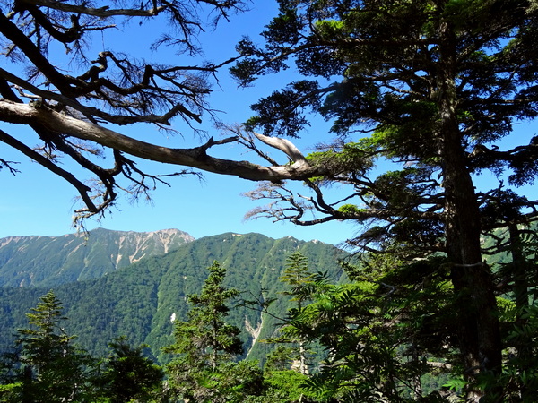 About two, two-and-a-half hours up, the forest opens up a little, and you begin to get nice views of the Mt. Yari ridge.
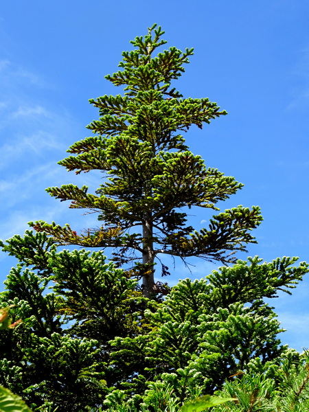 Beautiful trees glimmering in the sunshine.
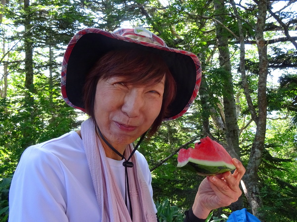 A first time ever. Somewhere near the top of the trail, a shop dealing watermelon. The trail was really crowded, at least at the bottom, as so many people start at the same time. There were at least a hundred folks eating watermelon in the ten minutes we were there.
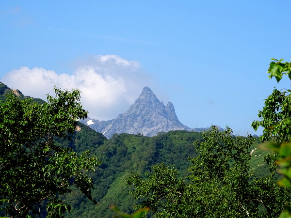 Finally, Mt. Yari comes into view.
 And most of the green gives way to blue.
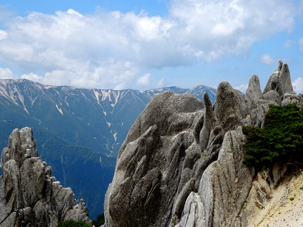
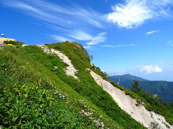
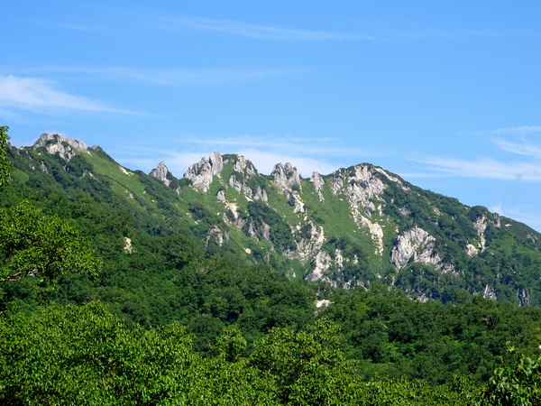 The Mt. Tsubakuro ridge.
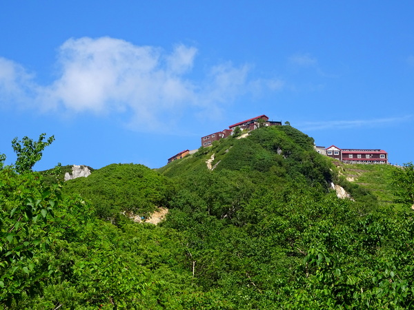 The lodge, at the top of the trail, comes into view.
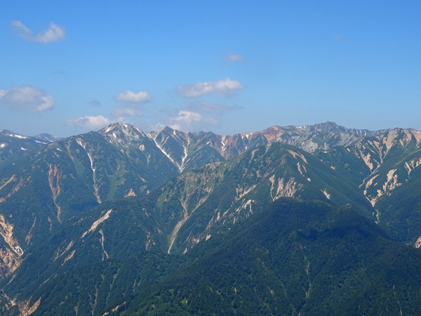
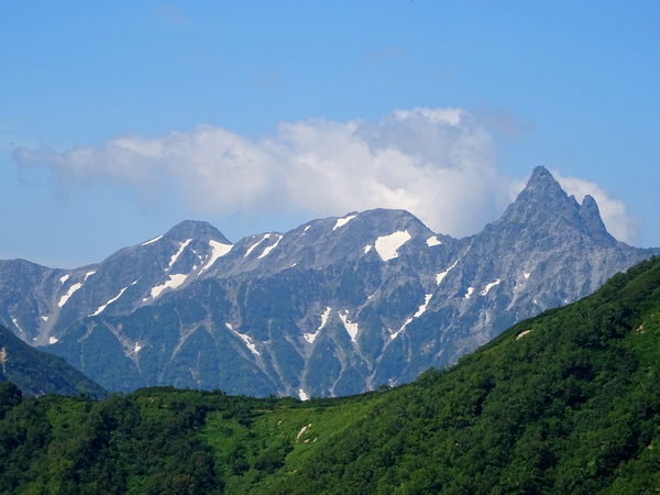 The Yari ridge gets bigger.
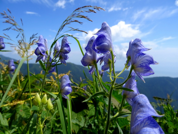
Torikabuto flowers (“monkshood” ) along the trail. Poisonous.
 Almost to the ridge. Hints of the campsite.
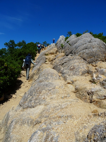
Finally, up to the ridge. The view opens up completely. For us about three hours to this point. Now it’ll be an hour or so over to the summit and back.
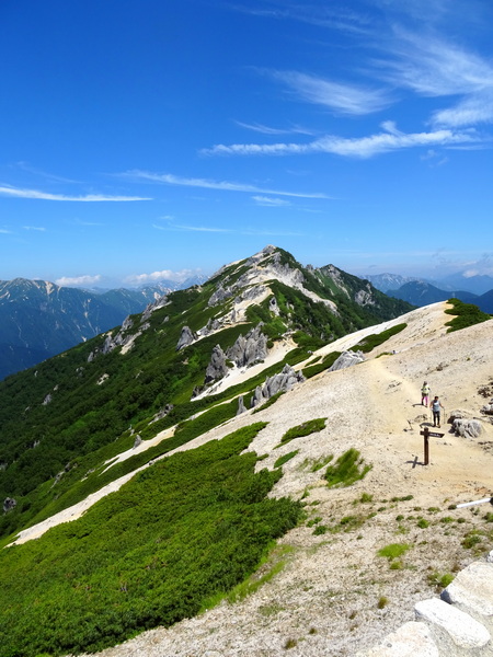
The view over to the Tsubakuro summit.
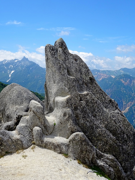
The famous “dolphin” rock. 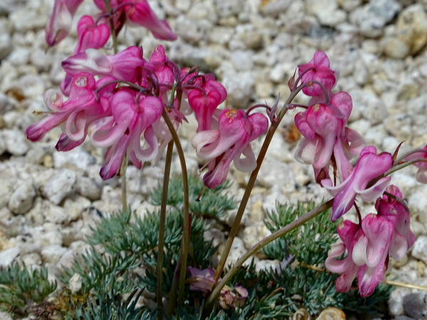 Komakusa flowers. Don’t know of any English name.
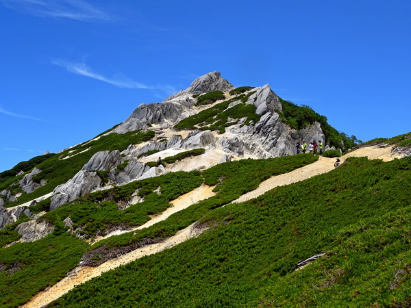
Gradually, the summit gets bigger.
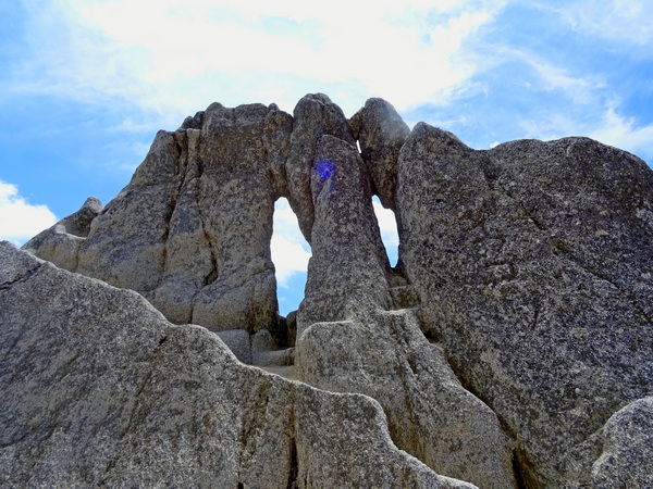 The megane (“eyeglasses”) rock.
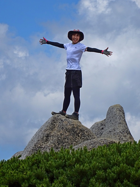
Hearty Hiker feeling mighty fine. 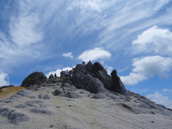
A minute from the top.