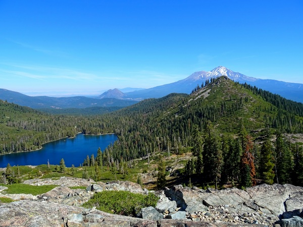
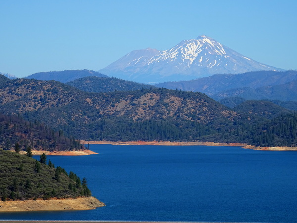
The drive from the town of Mt. Shasta to Castle Lake, a popular spot for camping, swimming, and kayaking, is about 10 km.
About.
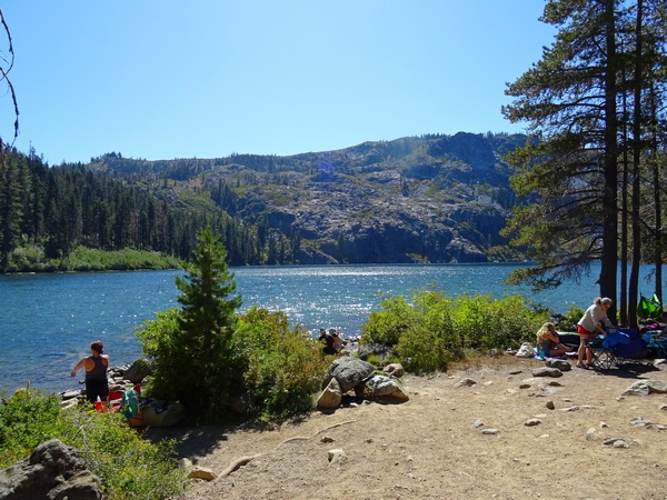
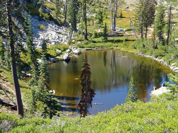
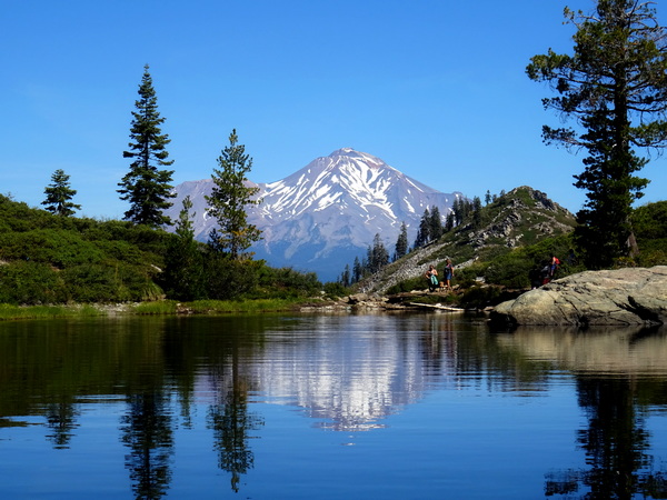
The hike up to Heart Lake starts there at Castle Lake (pictured above).
If you’re standing there in the sandy dirt, looking at at the tall cliffs at the opposite end of Castle Lake, just turn to your left and walk a bit . . . and you’ll be on the trail up to Heart Lake.
Round trip, it’s only about 3.2 km up and back down.
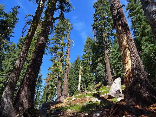
For a while, you’ll be in the trees, but it’s a rocky road most of the way.
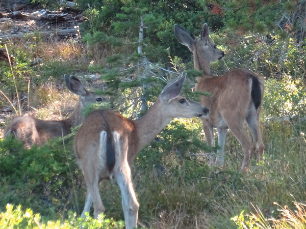
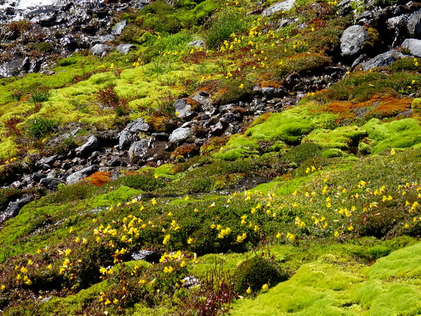
There are patches of green here and there, all the way. The deer prefer the green patches. Above, they are showing off their big ears. Or complaining about the racket the bipeds make trampling through the rocks.
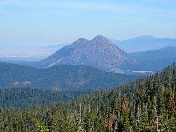
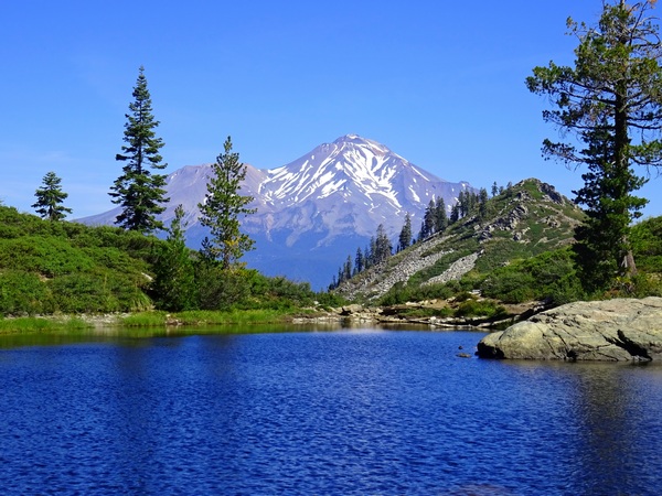
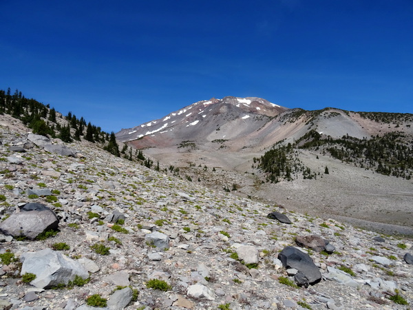
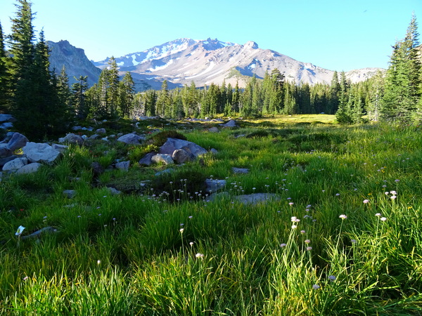
Before long, Black Butte comes into sight. (We climbed there the next day.)
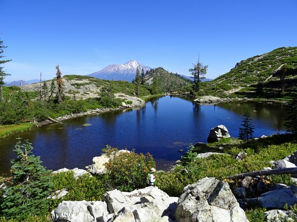
And then Mt. Shasta comes into sight.
Good views in the distant . . . and good views right at your feet.
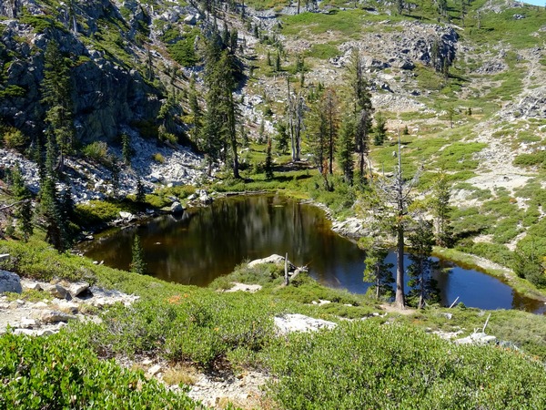
Then you’re at Heart Lake. That was no time at all.
Heart Lake is famous for how much it resembles a heart.
Depending on your personality, having heard that it’s shaped like a heart, you might want it to look like a heart when you cross over the little hill and it finally comes into view.
Of course, you’re clever enough to know that it might depend on what side of the lake you’re standing on, or how high above the lake you are, or (and this you won’t be able to do anything about), how much water is in the lake.
How about from here? A heart?
Well, I’ve seen shapes that are less heart-shaped, but the shape of the lake above can only be conceived as a heart if you imagine it as heart-shaped bread dough . . . that has been stretched out and slung across the room, bread dough that has smacked into a wall and then been peeled away and tossed out a window, bread dough that has fallen upon a rocky surface—its current location.
How about from here?
Nope, I don’t think so.
It is absolutely true that shapes in nature can help you feel the unity of nature. You can see the shapes repeated, see patterns forming. And you know that the pictures in wood grains or composed of round amoeba-like blobs of lichen on a big rock can be extraordinarily clear.
But being sure of exactly what you’re going to see before you ever get your eyes on it is probably not the wisest way to see something as it really is.
So beware.
But you have heard from lots of people that the lake is shaped like a heart. And you’ve flown all this way. Driven all this way. Hiked up all this way.
You circle the lake. Make sure you’ve covered all the angles.
Could it be? If you stretch your mind as wide as the “heart” has stretched itself?
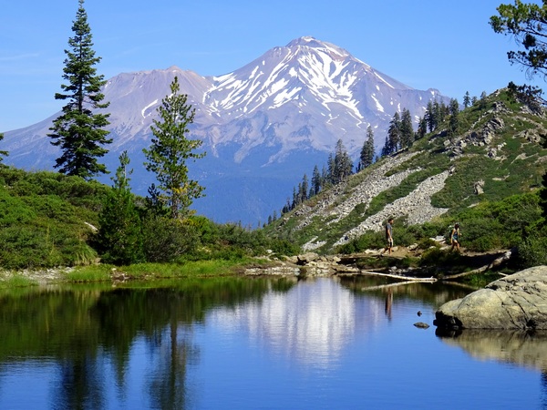
Regardless, if you’re lucky, if your mind has not become too preoccupied, too polluted, you might just realize that the water in the lake, from your current point-of-view, is gorgeous, that the view of Mt. Shasta is gorgeous, that the view of the lake, the green all about, Mt. Shasta, andthe hill between the lake and Mt. Shasta, is gorgeous.
If you don’t see that, then your pursuit of your heart vision has been destructive.
And that view of the lake may be so gorgeous, you may just plop your rear end down on a rock and enjoy it . . . and if you do that . . . you might begin to notice a hint of white reflection at the edge of the lake across the way.
And that white reflection may grow . . .
. . . and become clearer. And then a really big smile might come to your face. It might even get stuck to your face.
And stuck smiles like that are meant to be enjoyed there in the moment. So please do.
Forget about the “heart.”
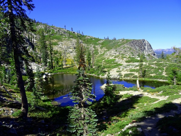
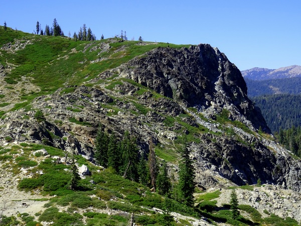
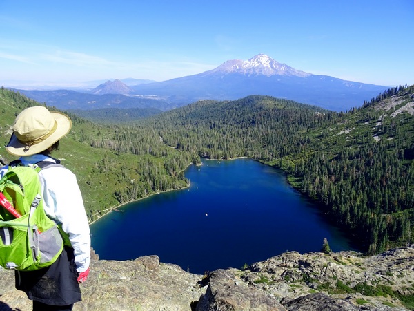
If you continue on past Heart Lake, you can walk up to where you can look right down on Castle Lake—right there at the right end of that green strip at the top of the photograph, right atop the rock cliff.
Were you to follow (with your feet) the green strip around to the left, you could semi-circle the back side of Heart Lake from a much higher vantage point. Were you to do that, you might get to some point from which Heart Lake does look very much like a heart.
But we didn’t go that far. Just to the point where we could look straight down on Castle Lake.
We were a mere five hours late getting into San Francisco, and somehow managed to check into our Redding hotel around 3:30 a.m. By 9 a.m. or so, we were in a rental car and on the road.
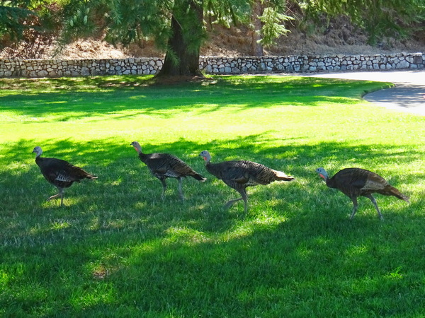
We made a quick stop at Shasta Dam . . .
. . . where nine (I think) turkeys strutted by, letting us know that we’d better not fall asleep in their back yard. Then we took two-lane Highway 44, heading west toward . . .
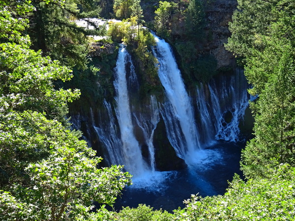
. . . Burney Falls, and amazing 120-foot waterfall on Burney Creek.
I’ll leave talk of Burney for another day.
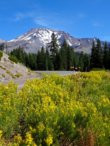
By nightfall, we’d reached our little B&B in the old lumbering town of McCloud, got a good night’s sleep, and were up and ready for the 15-minute drive over to Mt. Shasta (the city), and Mt. Shasta, the mountain itself.
From downtown Mt. Shasta, it’s pretty simple. Turn right on Lake Street, heading east, drive by the high school, and then the road changes names—becomes Everitt Memorial Highway, the only road up the mountain.
A lovely drive, wouldn’t you say?
We stopped at the Bunny Flat trailhead for a bit of information, discovered that if you’re entering the “Wilderness” area, you need a permit, though the permit is free (you just take one out of the book and write down your name). The big map made it look to us like everything was in the Wilderness area, but we weren’t really sure. We got permits, just in case.
If you’re planning on climbing over 10,000 feet (we weren’t), you need a summit pass. That costs $25. The summit takes you up over 14,000 feet.
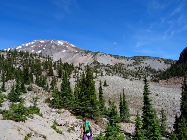
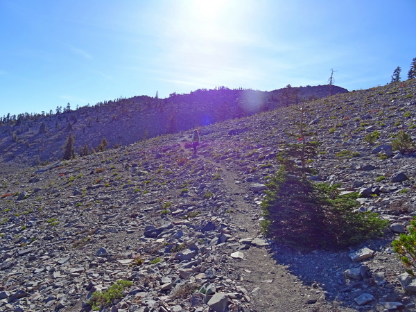
We drove on a bit farther up the highway to the Panther Meadows campground, at 7500 feet. We’d done some research, but because you can get to certain points from different starting places we were slightly (okay, quite) confused about the best route.
But to make a long story short, from the campground, we skirted Lower Panther Meadows on the Grey Butte Trail, turned left at the junction (right to Grey Butte, left to South Gate Meadows), walked to South Gate Meadows, climbed up to the spring, climbed back down, walked a different road back, to the Old Ski Bowl, and from there, walked down through Upper Panther Meadows and Lower Panther meadows, and back to the campground and our rental car.
It’s maybe four hours of easy to moderate walking. It took us about seven. Hopefully, the photographs will explain why.
We talked to several folks at the parking lot, trying to settle on the most interesting route, and finally ended up deciding to go the same way a very sweet lady in a sun dress and sandals was going. Yep, for many, it’s that sort of hiking. Us, we had on our regular hiking boots. Maybe more about that later.
The above shot is of Lower Panther Meadows. This is very sacred ground for the indigenous people. The signs say very clearly to stay on the single, narrow trail, and that seemed like a good idea to us.
There’s no church building, no man-made structure designed for worship, but for the indigenous people, hikers walking on the fragile plants that make up the meadow is no different from intruders breaking into Notre Dame Cathedral and taking a crowbar to all the stained glass.
Regardless of how much “sacredness” a person feels (though we certainly felt a lot the whole day long), the ecosystem is fragile. At least when heavy human beings comeonto the scene. A species that takes 40 or 50 years to mature can be stepped on and killed in a half of second.
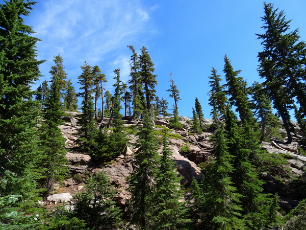
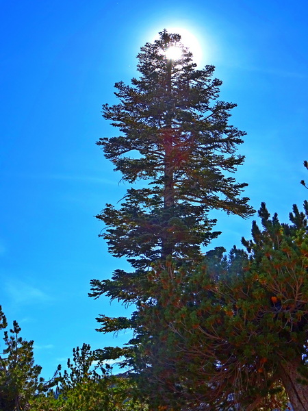
So we skirted Lower Panther Meadows and headed into the Red Firs and other conifers (we weren’t always sure what conifer was what) . . .
. . . and made our way along the Grey Butte Trail.
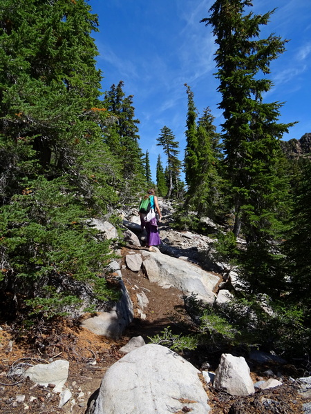
We were glad to have an informal guide. In sandals.
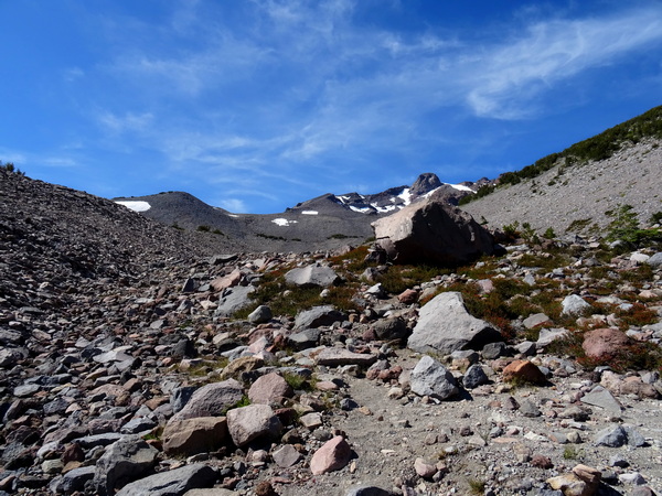
Once you’ve turned left at the junction and set your compass for the South Gate Meadows, there are generally less trees . . .
. . . and lots and lots of rocks. And even in September, at 8000 feet or so, here and there, patches of snow. There are also zillions of . . .
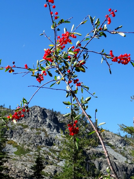
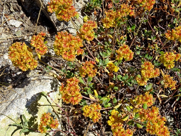
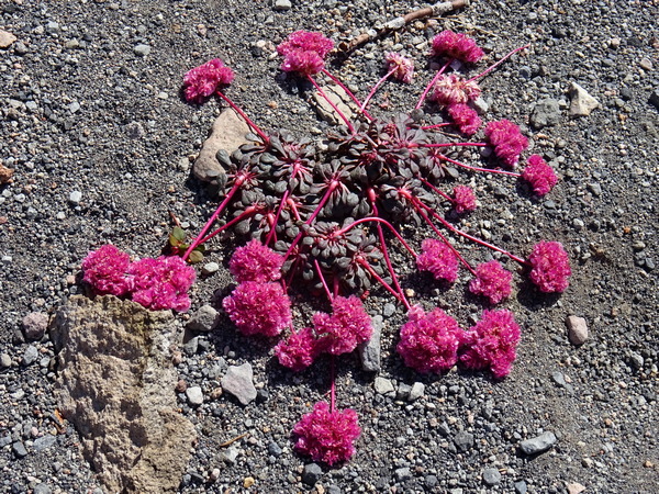
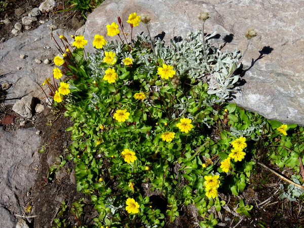
. . . wildflowers! The above flower, not surprisingly, is called Pussycat Paws.
I said “zillions,” but that is only a slight exaggeration. I’ve since downloaded an app for identifying “North California Wildflowers,” and if you just do a search for “wildflowers” in “rocky” areas, you’ll get over 1000 hits.
Of course, some only bloom at certain times of the year, but there were lots blooming in September.
Lots.
So lots of joy.
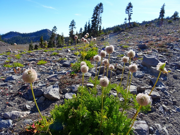
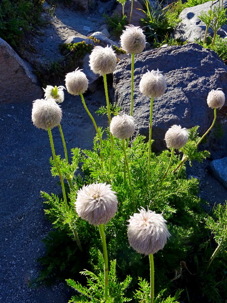
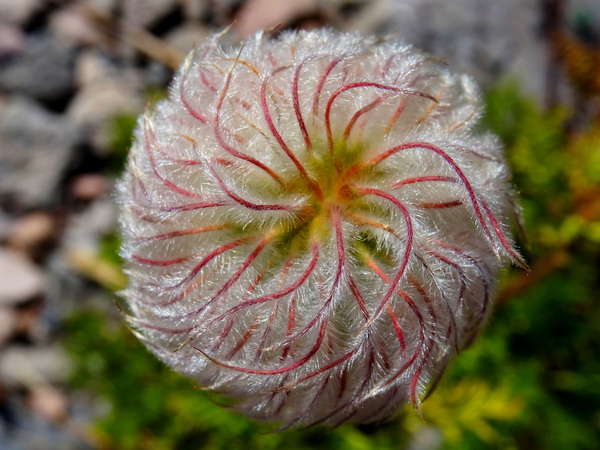
I didn’t find the name for every flower we came across, but did find names for the plants . . .
. . . that made my heart do particularly pleasurable cartwheels.
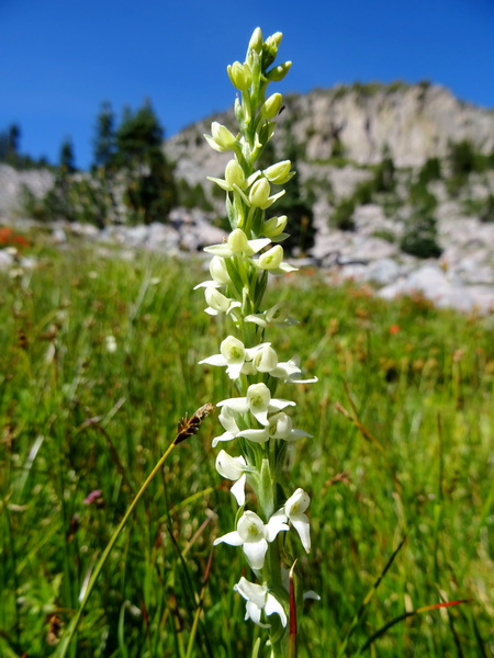
These are seedheads of a plant with relatively plain and small white flowers—the Western Pasqueflower.
I fell madly in love with them. Their spirals seemed too clever and too cute to be true.
But they were true. That’s the good thing about nature. You know that all it’s composed of is always true. No lying.
So it was a great walk through the rocks looking at all sorts of flowers that we’d never seen before.
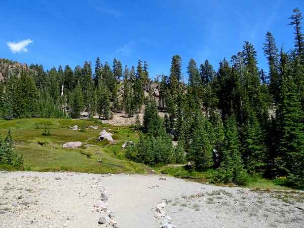
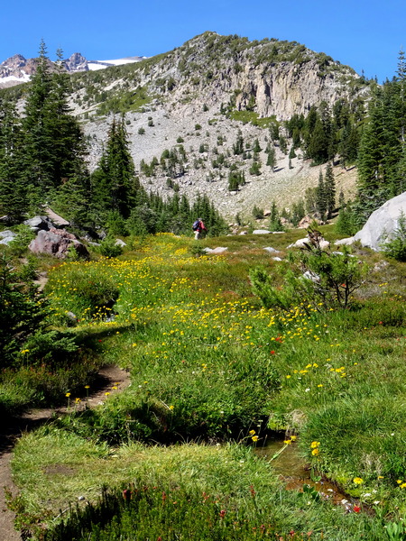
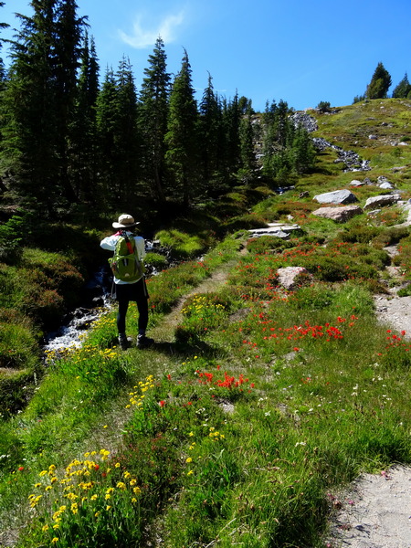
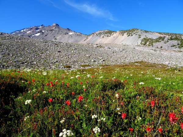
And then up ahead, we could see a strip of green. The strip got bigger and wider the closer we got.
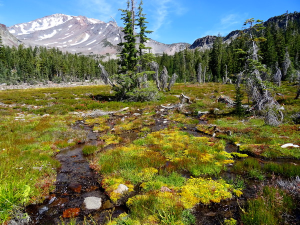
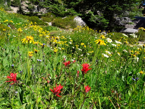
The South Gate Meadows!
Flowers everywhere. A whole new set of flowers. Alpine meadow flowers.
Flowers everywhere, but they were especially thick, naturally, along the stream that flowed from the spring another twenty, thirty minutes up the mountain.
You may think I’m prone to exaggeration, but I sincerely hope you’ll believe me when I say—and I choose the word carefully—it was . . .
GLORIOUS!!!
The indigenous people believed it was wrong to climb to the top of Mt. Shasta. The summit was where the Gods lived. But the Gods at the summit had provided the snow, and the snow seeped into the mountain, and a bit down the slope the vast store of the mountain gushed out in amazing streams, and that water was a true gift from above (any way you look at it that has to be true), and you could walk up far enough to take of the water, and the meadow that sprung up in that place would feel as much a heaven on earth as any place could, and yes, you might just feel that the very spot you stood was the very spot where heaven and earth met, and you could sense certain metaphysical laws and truths, and those laws and truths would be spiritual in nature, too, and you’d seem to understand all that anyone ever could understand–but not through thinking–and you’d feel that what you understood–or rather, what you became aware of, was as much as you could ever hope to be aware of.
Yes, we got carried away, emotionally, standing there with the meadow and the rocky top of the mountain right before us, but I am not getting carried away with my language now. This is what we felt. Spontaneous feelings recalled in tranquility.
It was the best spot a living being could be, so we were in no hurry to leave. We stayed for about an hour at the bottom of the meadow. For about half that time, we were the only two people in sight.
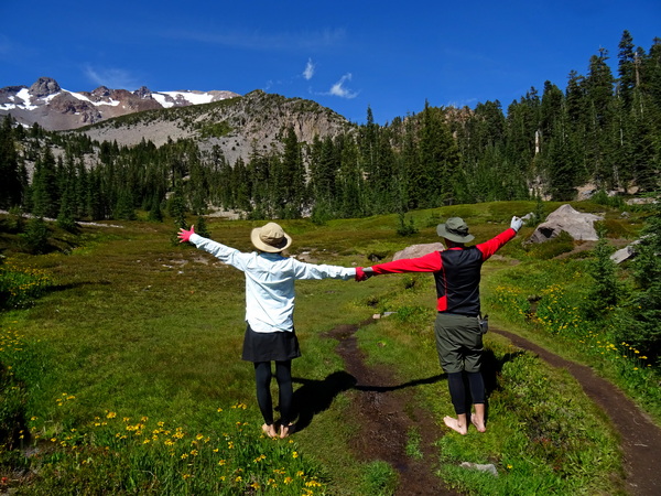
We did, however, have a chance to talk with our guide a bit, there at the bottom of the meadow. About twenty minutes before we’d gotten to the meadow, she’d taken off her sandals and gone barefoot. To go easier on the land, she said, and also to feel the land.
This was easy for me to understand. I spent a lot of time barefoot as a kid, and recently, even with boots on, on a spongy trail, feel that the bottoms of my feet can sense what’s going on deep down in the ground, can feel how the roots of trees are gripping the dirt deep down. Anyway, we Hearty Hikers took our shoes off, too, and the moist ground by the stream felt really good.
Well, there are all kinds of climates, and all kinds of considerations, but it’s worth a few minutes of thought to ask ourselves how wise it is to keep our feet bundled up in shoes all the time we’re out and about in the world. A lot of things can be transmitted through feet.
All the flowers.
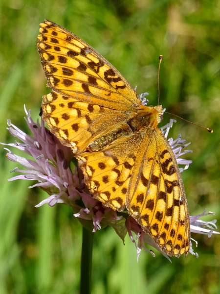
And the tortoiseshells. They were in migration. The sky was never thick with them, but there was a constant stream, a river, two or three or four them at a time, all on the exact same path, heading down toward McCloud, toward the heart of California, toward Mexico.
At last, we headed up the stream, heading for the spring.
Endless flowers.
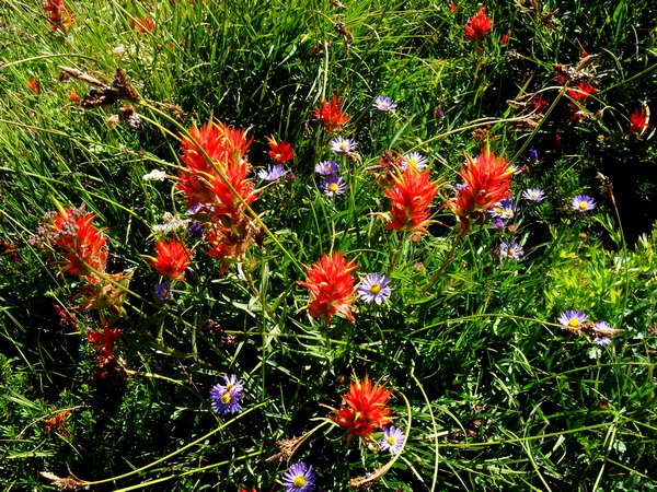
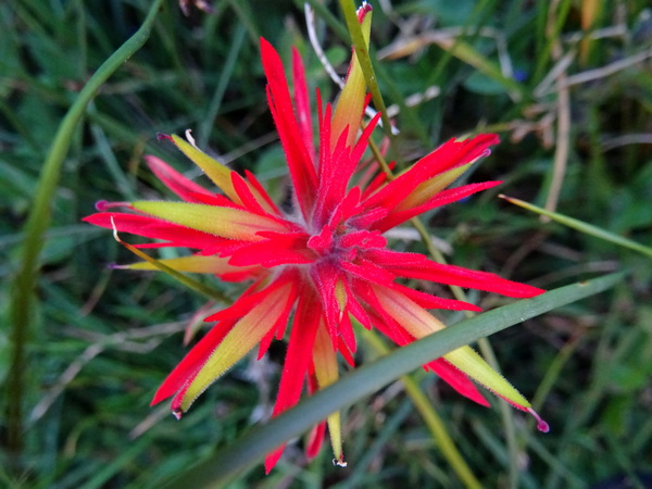
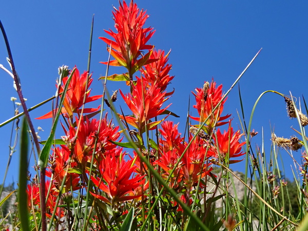
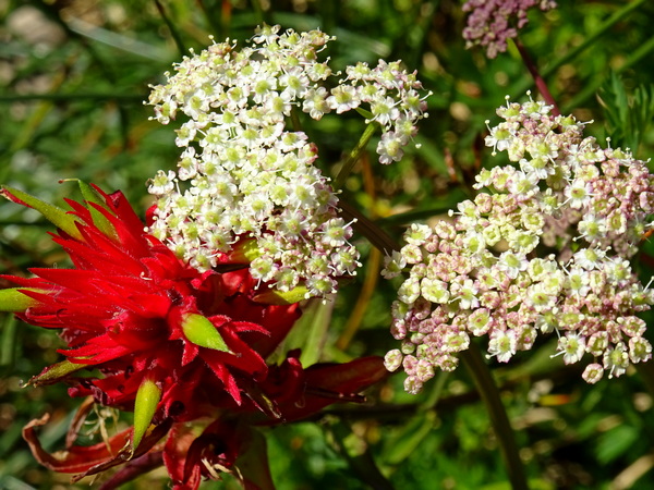
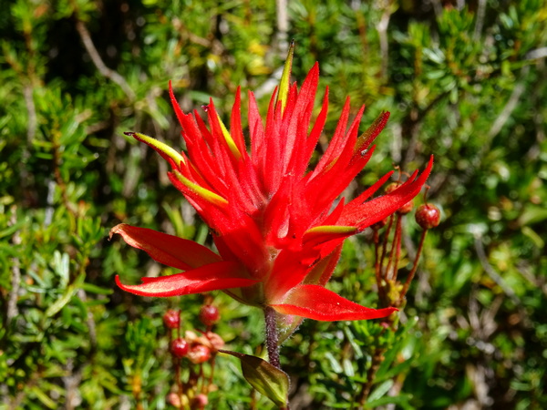
And this one, too, Indian Paintbrush, tickled my fancy.
The season, the red against the blue, the way the flowers clumped, reminded me of the spider lilies all over my neighborhood here in Shizuoka.
Some people, you know, say that Mt. Fuji and Mt. Shasta are connected in some way or another. I don’t know, but they do say that. There does seem to be some connection between the spider lilies and these paintbrushes. I don’t think such a similarity would have surprised Alexander Humboldt, the Prussian naturalist/geologist who’d crossed an ocean to cross the Andes.
Up, up along the stream we went.
Careful to stay on the thin trail.
And we just let our eyes devour all they could.
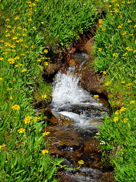
And then we were up to where the water came out from the ground, came out as a wide stream, came out streaming strong over the bed of rocks.
We climbed up a bit farther, stood just above the spring and looked up the mountain. I would have thought the hiker in me would have said, “Let’s go!” . . . but he didn’t.
This day we’d come as high as we needed to.
The first half back was along the same trail, but a trail taken twice is never the same both times. At the least, the light changes. Angles of perception change, too.
We turned off toward the Old Ski Bowl. Another rocky trail.
With the occasional spring, and a meadow, however small, flourishing along its waters.
The Ski Bowl trail brings you back to the Everitt Memorial Highway. And then a slight jaunt down the road takes you to the trailhead of . . .
. . . Upper Panther Meadows. From there it is just a fifteen- or twenty-minute walk through the meadows (of course, on the trail) and back to where you left your rental car.
At the top of Upper Panther Meadows is, of course, a spring. This time, the spring is a pool a couple of feet deep. It reminded me of a private bathtub attached to an expensive room in a nice hot springs resort in Japan.
The bottom is sandy, and thus, it’s easy to “see” the water bubbling up from the bowels of the mountain.
And it’s quite a sight. And you can’t help thinking of all the good stuff that’s going on down there, down there in the Earth. I guess that’s a big reason why the indigenous people preferred not to dig down into the Earth, not if they could help it.
Yes, yes, of course, I tried to take a picture of that bubbling sand. But I couldn’t. Not a picture that would allow you to see what I saw. But that’s the way it goes. Sometimes, the most important things, you can’t capture them with a photograph.
It’s hard as hell to capture them with words, too.
(from Persimmon Dreams: When you’ve got a spare moment, check out our music/nature videos on our “Persimmon Dreams” YouTube channel, or Steve’s books, When a Sissy Climbs a Mountain in May and Along the Same Street, available on Amazon, or directly from us.)