We hiked down from Mt. Miyanoura and spent the night in the Shintakatsuka Lodge, which meant if we started hiking at 5 AM, we’d get to the most famous cedar tree in Japan, Jomon Sugi, around 6:20. Most people (several hundred, I’d guess) were hiking UP to Jomon Sugi and would probably get there around 10 or 11 AM, but only about fifteen or so of us were hiking DOWN to the tree. Which was good for us. We got our good look at the tree with just a few other folks around.
After about an hour of hiking the day broke.
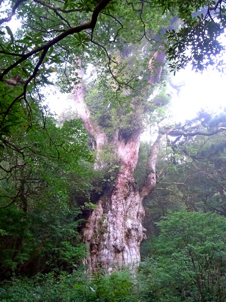
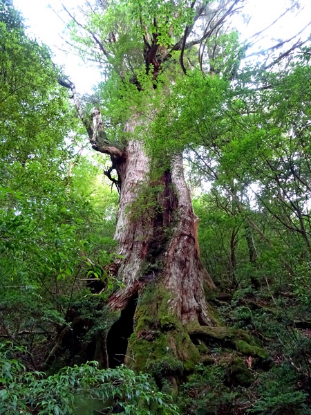
And then we were standing in front of the Jomon Sugi. Hikers aren’t allowed to get close to the tree, and the wooden viewing deck is some 30 or 40 meters off, so with a regular little camera, or maybe any camera, it’s hard to take a picture that shows its immensity—but it is truly immense. Not so tall, only 25 meters, but very, very stout. The chest-high circumference is 16.4 meters. Estimated age is somewhere between 2000 and 7200 years old. It’s much bigger than a number of trees presumed to be 3000 years old, but some folks suggest that it’s actually more than one tree, that several trees grew together, and it’s that big not because of its age, but because of the marriage it underwent. Somehow, I feel it’s probably a lot older than 3000 years old—but that’s just a feeling.
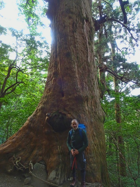
Down the trail from Jomon, Dai-ou Sugi. A mere 11.1 meters in circumference chest-high and an estimated 3000 years old.
Compared to the big and famous cedars, this one is just a little baby.
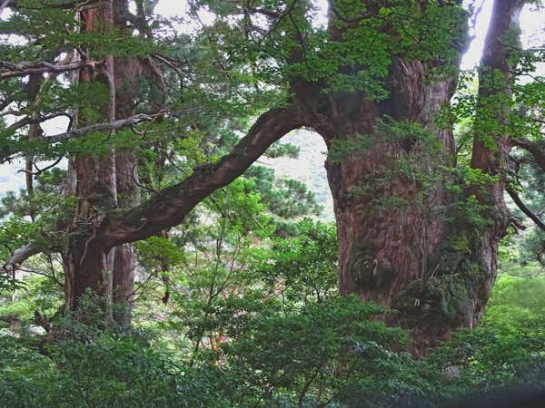
The Meoto Sugi, the “Husband and Wife Cedar.” The “wife,” on the right, is 5.8 meters in circumference chest-high and an estimated 1500 years old. The “husband” is 10.9 meters in circumference and an estimated 2000 years old. Their bond seems strong indeed.
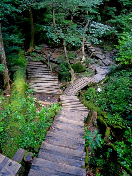
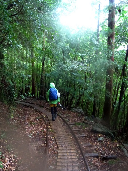
Most of the trail is composed of wooden steps, one, to encourage people not to wander off the trail and into the fragile environment, and two, to put the hiker’s feet above all the water that’s running every which way and surely gets fairly heavy whenever it rains.
And it rains, they say, on this part of the mountain, almost every day.
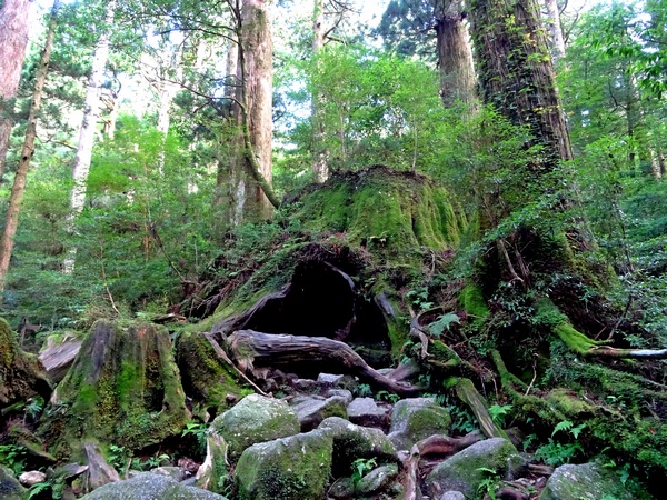
Near the bottom of the Oh-kabu Path, you come to “Wilson’s Stump,” named for an English botanist who did a lot of work with cherry tree varieties—and also introduced the stump to English readers.
The tree was reportedly cut down at the order of Hideyoshi Toyotomi, in 1586, in order to build a temple in Kyoto, though whether the lumber actually made it to Kyoto or not is unclear.
It was 13.8 meters in circumference when it was cut down and perhaps a little more than 2000 years old.
You can get up close and cozy with this tree. You can walk inside, and if you stand in just the right spot . . .
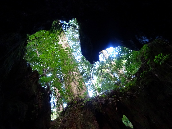
. . . you can see a heart. Not one of the tens of thousands of hikers who step into Wilson’s Stump every year has not taken this photo. There is a Shinto Shrine inside. As many as 25 people can be inside at one time . . . though thankfully when we Hearty Hikers were inside it was just us two.
Looking up at the rising trees and the light from the inside of this stump was perhaps the highlight of the day for me.
I like light, like the perception of light.
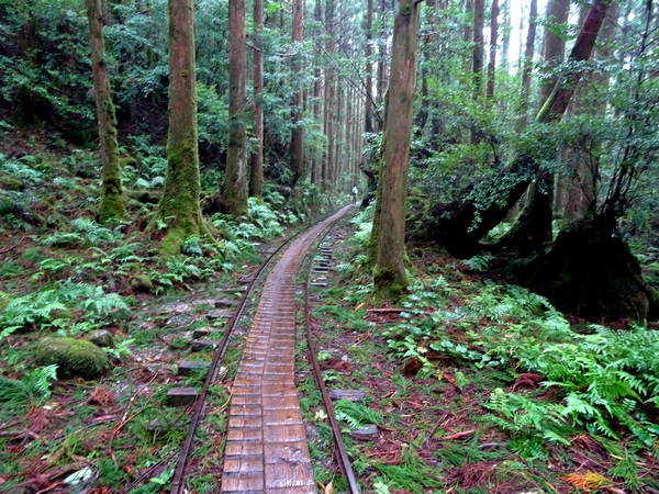
Just below Wilson’s Stump, you come to the end of the Oh-Kabu Path and to a rest area—the last toilet for those on their way up. From the rest area, you hit the railroad tracks that most Jomon hikers follow the entire 7.5 km back to the bus stop.
The railroad tracks remain from the logging days.
We got a little rain here, which was great. It wouldn’t have been a real Yakushima experience without experiencing the big drops on our heads walking along the tracks.
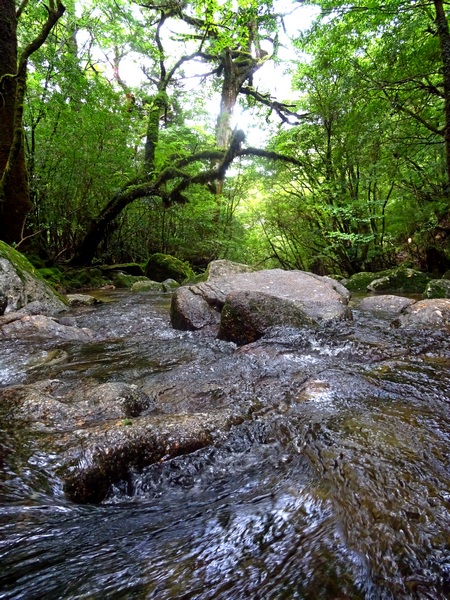
A river flowing under the railroad tracks.
More railroad tracks. The cedar plumes on the ground a sign of the most recent typhoon. We saw some monkeys around here, but they wouldn’t stand still for pictures. Got lots of fuzzy pictures. (Better monkey pictures on Day 3.)
We only followed the railroad tracks for about half the 7.5 km, then veered off on the trail that leads to Shiratani Unsui Gorge.
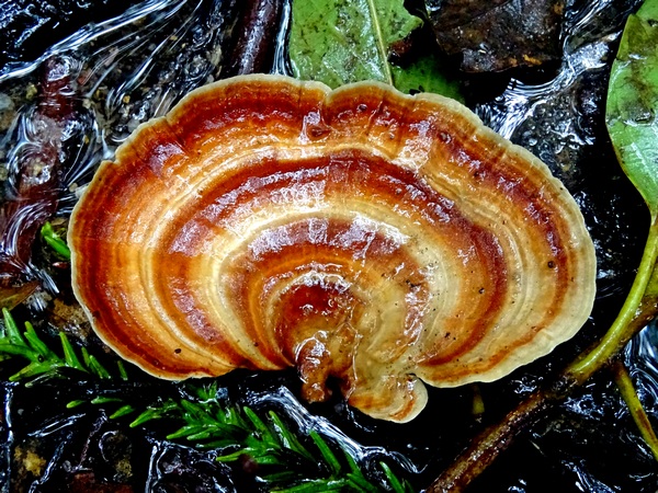
A mushroom.
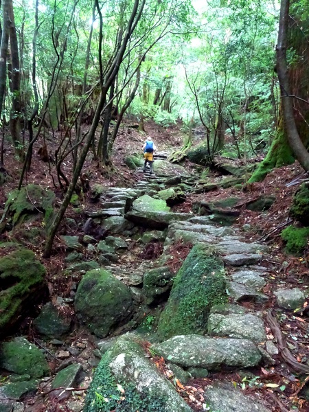
The trail leading to Shiratani. All up.
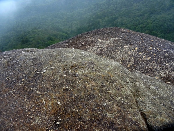
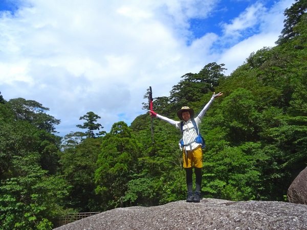
Just as you get to the top of the ridge and you’re poised to go down into the Shiratani area, there’s a side trail that takes you up to Taiko Rock. When we got up there, the mist had rolled in, but you could see that it would be a spectacular view on a clear day. A big river rushes down the mountain it faces. We’d had beautiful 360 degree views atop Mt. Miyanoura the day before, so we were not upset not to get a clear view from Taiko.
And we’re glad there is weather. That there is rain. That there are forests to hold the rain. Great breathing.
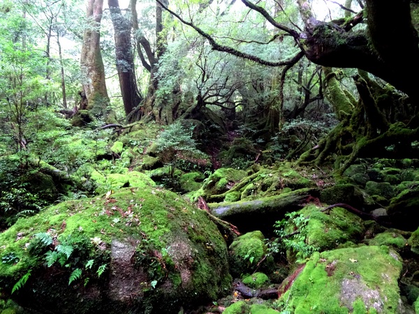
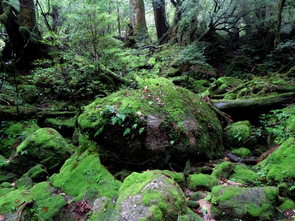
The Shiratani area is famous for its moss and is said to be the inspiration for the mossy forests in certain Japanese animations. A bit of rain here, too—just what I’d been hoping for.
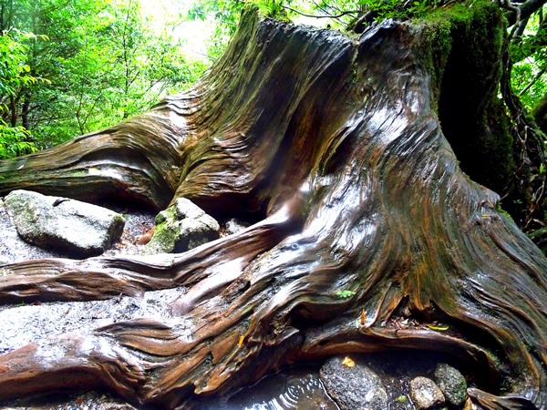
A shiny cedar stump along the river path.
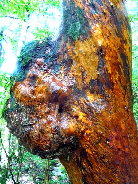
A shiny—and knotty–himeshara tree.
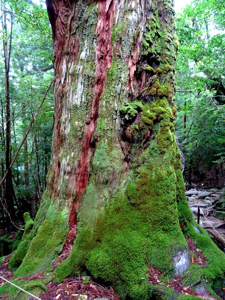
Nanahon Sugi.
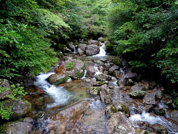
The Shiratani River.
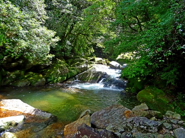
Walking along the river.
The skies cleared just as we were finishing up. Started at 5 AM. Finished around 1:30 PM.