We had some flexibility with the days we could get out of Shizuoka, so we patiently waited for the weather forecast to improve, then on August 25 drove the three hours to Nagano, parked, and caught the bus into Kamikochi, for a three-day hike up and down Mt. Yari.
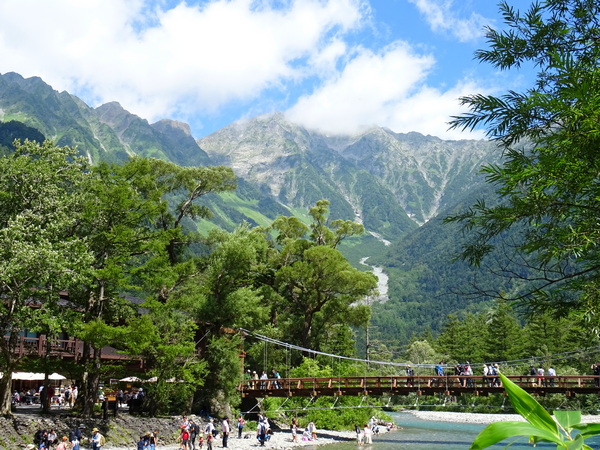
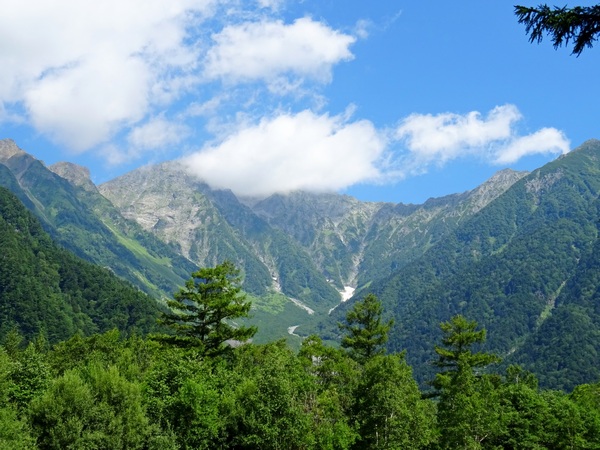
Kamikochi is a tourist haven, but it’s also the jumping off place, for as many different hikes for as many days as you can imagine up into the Hotaka mountain range (above), Mt. Yari, and lots and lots of other mountains in the area. Also, above, the well-known Kappabashi Bridge, souvenir shops on both sides.
Just walk a bit farther, though, fifty meters or so, look out at the same view, and there’s a different atmosphere. Now there’s just you . . . and the long walk ahead of you.
To the top of Mt. Yari and back is approximately 39 kilometers, with an altitude climb of 1675 meters. Our plan was to walk as far as Yarisawa Lodge (thirteen or fourteen kilometers, but only 200 meters or so up , about five hours according to average trail times), then climb the last six kilometers in distance and 1400 meters in altitude the second day.
Anyway, the first day of hiking was all along the river, crossing lots and lots of side streams and . . .
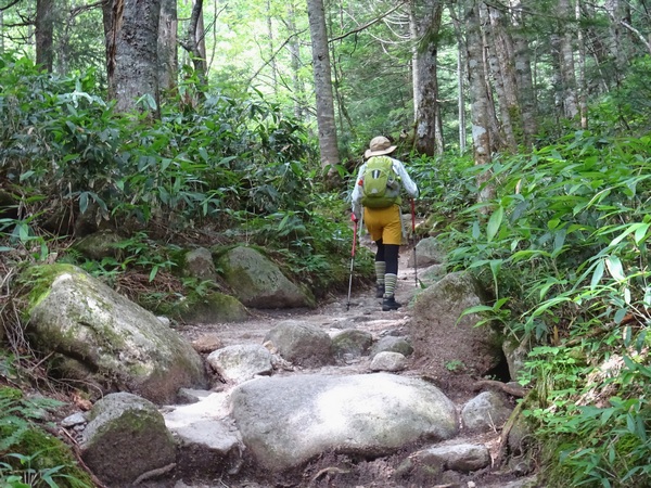
. . . through the woods.
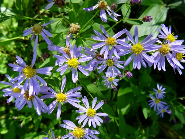
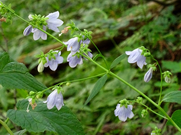
Of course, one of the joys of such an Alpine hike is the host of flowers you come across along the way.
Go ahead. Stop. Snap a few pictures. Smile.
We needed to be at the lodge by about 4:30 PM. We’d started about 10:30. We had plenty of time. If I have any advice, it is this: make sure you have enough time to stop and look at things. There arelots of things out there.
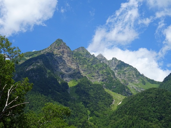
From time to time, the view opens up on your left. Above Mt. Myojin, a sacred mountain . . . though of course, they’re all sacred mountains.
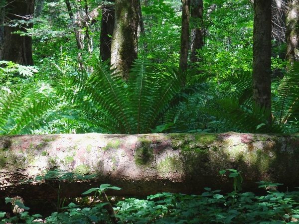
“Composition in log and fern.”
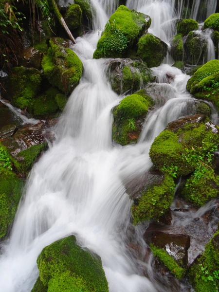
Spent a bit of time playing around with shutter speed. Actually, the above shot was taken on our third day, coming down. On the first day, the sun was too bright to take a good picture here.
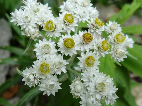
There’s not an English name for this flower, as far as I know, but the Japanese translates as “Mountain Mother and Child.”
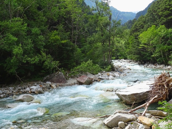
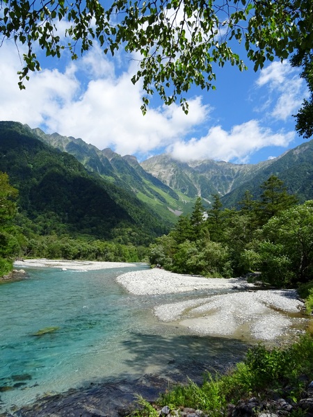
Upstream its called “Yarisawa,” the Yari Creek, or Yari Stream, downstream when its bigger, “Azusagawa,” The Azusa River.
About sixteen or seventeen of the nineteen kilometers to Mt. Yari, you’re walking along this water.
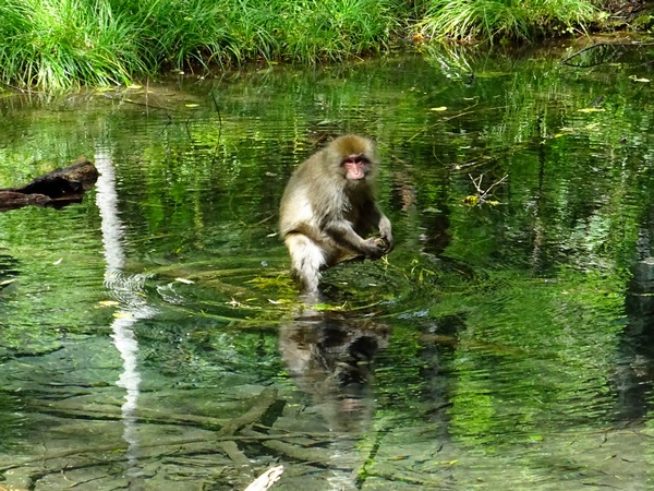
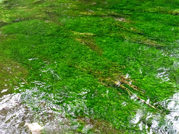
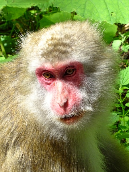
What’s this? A monkey? A monkey in a green pool?
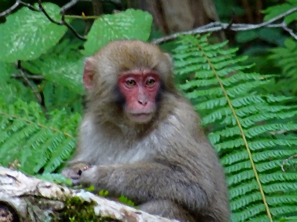
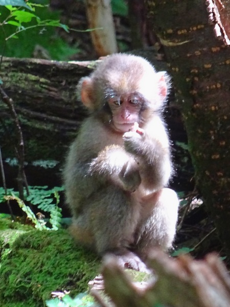
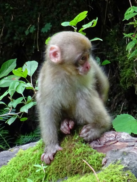
This was the first monkey we saw, but before we knew it, we realized we were in the midst of seventy or eighty, on both sides of the trail.
Twenty minute delay. To watch the antics of the little babies. To study communal grooming techniques. To discern attitudes.

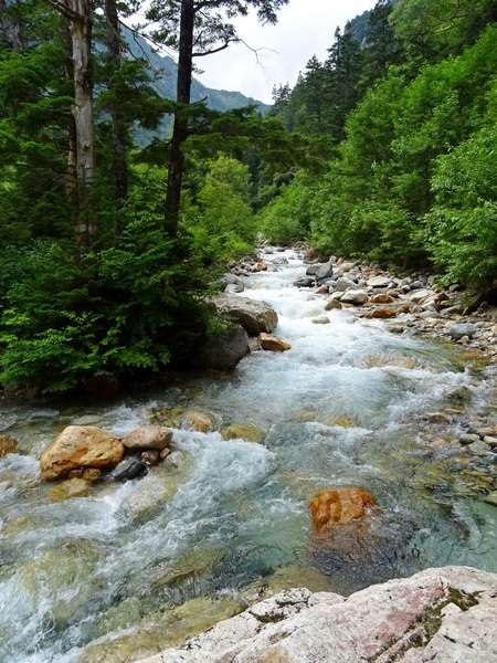
The clear water of the stream, the orange of the rocks, the blue tint, how all that refreshes your soul. I’m going to get my Hearty Hiking partner to write a tanka poem about that.
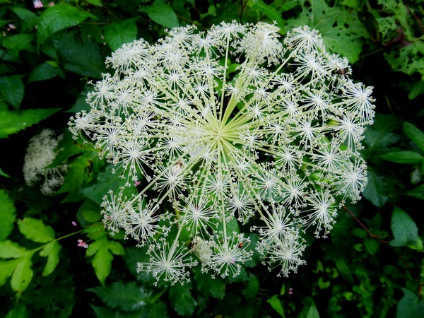
シラネセンキュウ(白根川芎) Shiranesenkyu
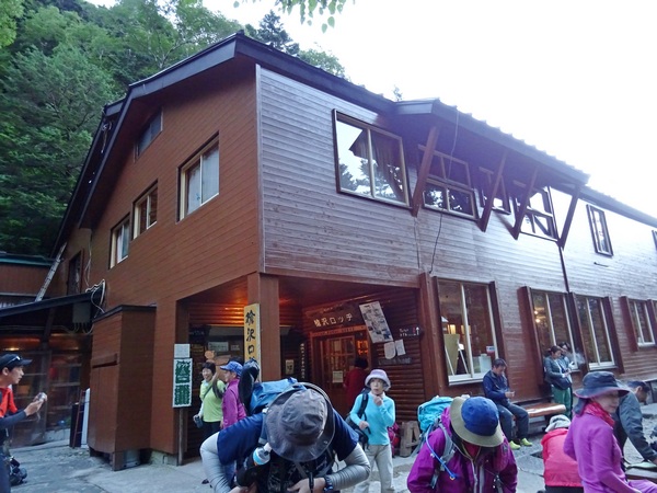
Finally, the Yarisawa Lodge, up about fifteen meters from the river. We got there in under five hours, and that with a lot of time spent with the monkeys and flowers, a lot of time playing with the camera shutter, a lot of time just listening to river–and breathing deep.
In the morning, up to Yari!
(from Persimmon Dreams: When you’ve got a spare moment, check out our music/nature videos on our “Persimmon Dreams” YouTube channel, or Steve’s books, When a Sissy Climbs a Mountain in May and Along the Same Street, available on Amazon, or directly from us.)