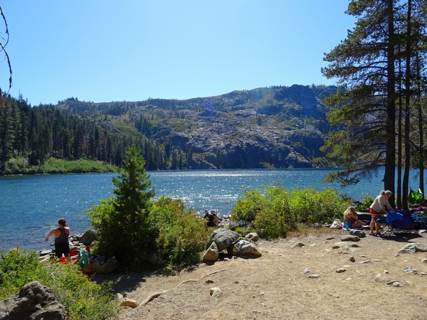
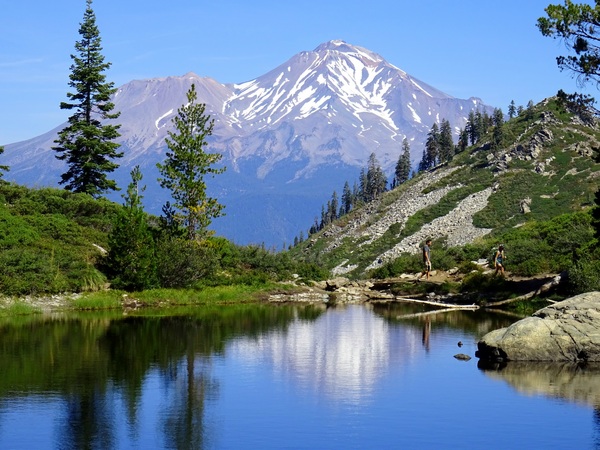
The drive from the town of Mt. Shasta to Castle Lake, a popular spot for camping, swimming, and kayaking, is about 10 km.
About.
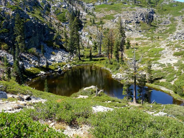
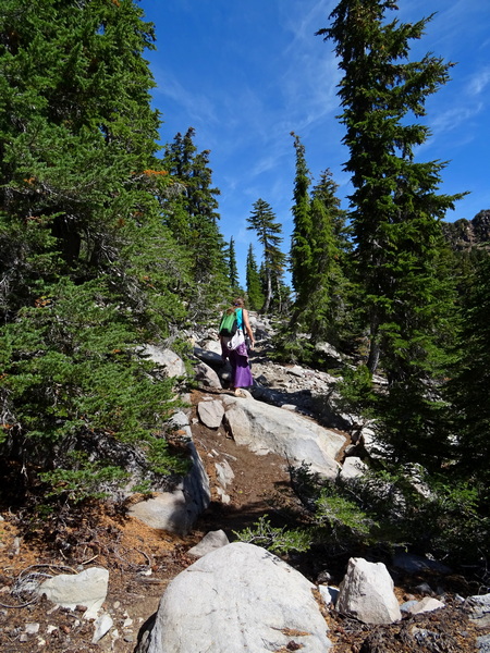
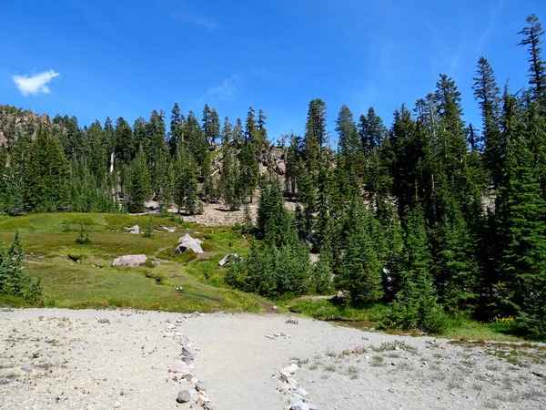
The hike up to Heart Lake starts there at Castle Lake (pictured above).
If you’re standing there in the sandy dirt, looking at at the tall cliffs at the opposite end of Castle Lake, just turn to your left and walk a bit . . . and you’ll be on the trail up to Heart Lake.
Round trip, it’s only about 3.2 km up and back down.
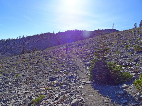
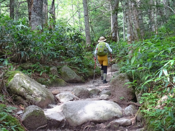
For a while, you’ll be in the trees, but it’s a rocky road most of the way.
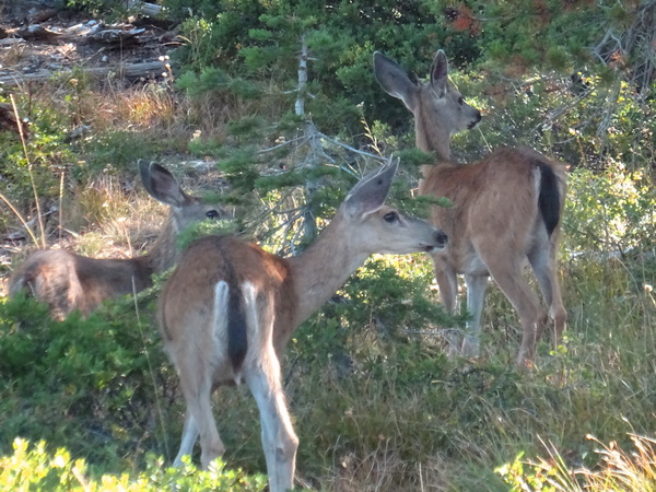
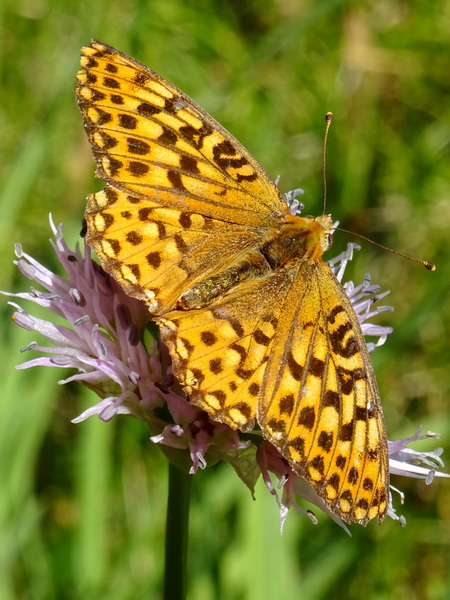
There are patches of green here and there, all the way. The deer prefer the green patches. Above, they are showing off their big ears. Or complaining about the racket the bipeds make trampling through the rocks.
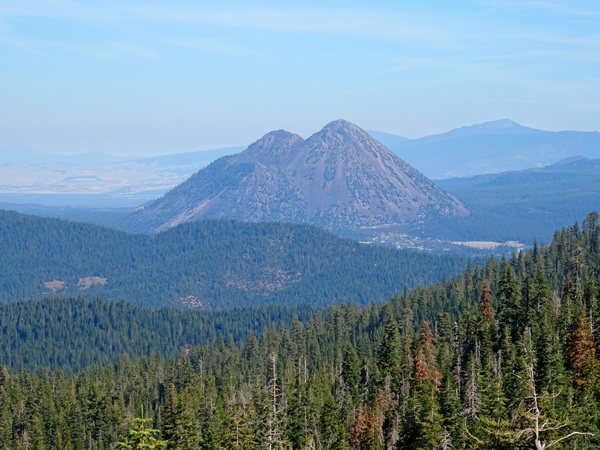
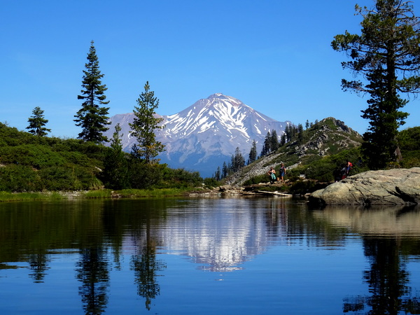
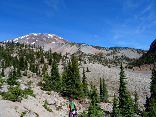
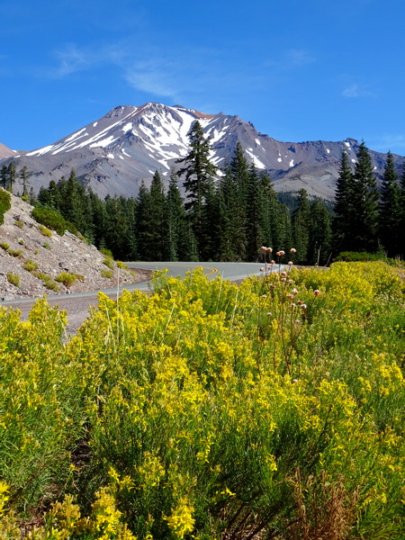
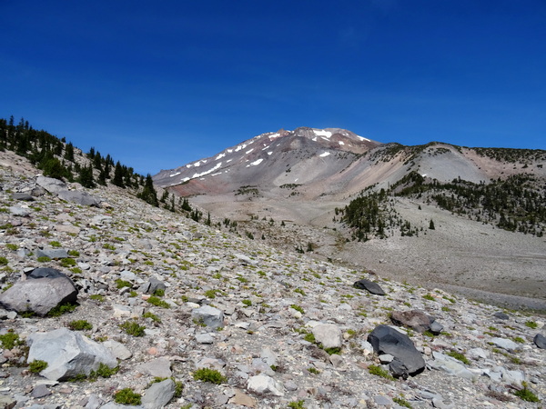
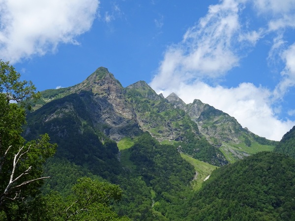
Before long, Black Butte comes into sight. (We climbed there the next day.)
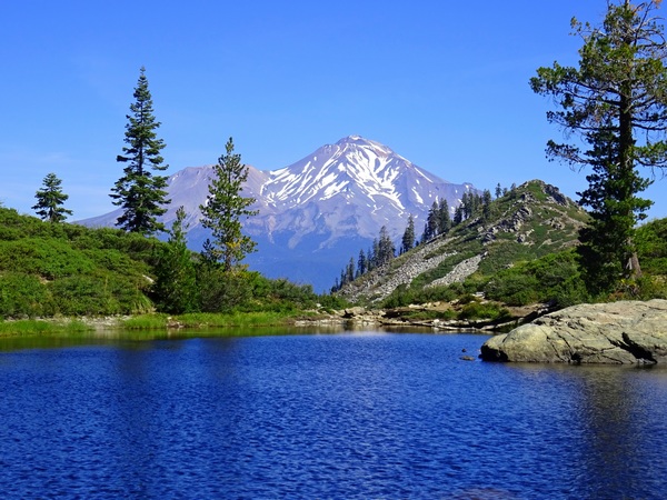
And then Mt. Shasta comes into sight.
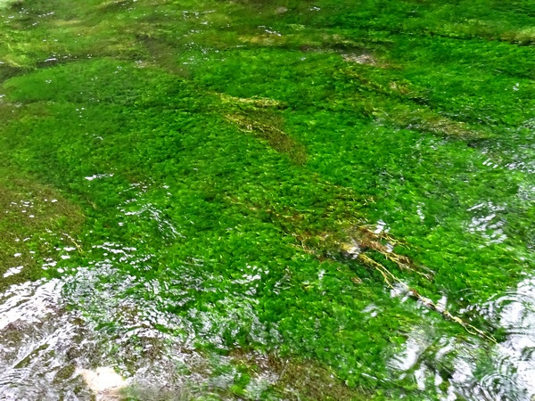
Good views in the distant . . . and good views right at your feet.
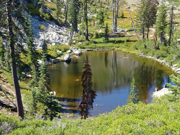
Then you’re at Heart Lake. That was no time at all.
Heart Lake is famous for how much it resembles a heart.
Depending on your personality, having heard that it’s shaped like a heart, you might want it to look like a heart when you cross over the little hill and it finally comes into view.
Of course, you’re clever enough to know that it might depend on what side of the lake you’re standing on, or how high above the lake you are, or (and this you won’t be able to do anything about), how much water is in the lake.
How about from here? A heart?
Well, I’ve seen shapes that are less heart-shaped, but the shape of the lake above can only be conceived as a heart if you imagine it as heart-shaped bread dough . . . that has been stretched out and slung across the room, bread dough that has smacked into a wall and then been peeled away and tossed out a window, bread dough that has fallen upon a rocky surface—its current location.
How about from here?
Nope, I don’t think so.
It is absolutely true that shapes in nature can help you feel the unity of nature. You can see the shapes repeated, see patterns forming. And you know that the pictures in wood grains or composed of round amoeba-like blobs of lichen on a big rock can be extraordinarily clear.
But being sure of exactly what you’re going to see before you ever get your eyes on it is probably not the wisest way to see something as it really is.
So beware.
But you have heard from lots of people that the lake is shaped like a heart. And you’ve flown all this way. Driven all this way. Hiked up all this way.
You circle the lake. Make sure you’ve covered all the angles.
Could it be? If you stretch your mind as wide as the “heart” has stretched itself?
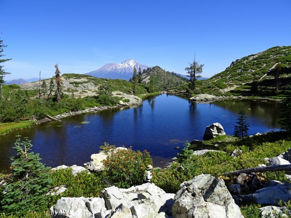
Regardless, if you’re lucky, if your mind has not become too preoccupied, too polluted, you might just realize that the water in the lake, from your current point-of-view, is gorgeous, that the view of Mt. Shasta is gorgeous, that the view of the lake, the green all about, Mt. Shasta, andthe hill between the lake and Mt. Shasta, is gorgeous.
If you don’t see that, then your pursuit of your heart vision has been destructive.
And that view of the lake may be so gorgeous, you may just plop your rear end down on a rock and enjoy it . . . and if you do that . . . you might begin to notice a hint of white reflection at the edge of the lake across the way.
And that white reflection may grow . . .
. . . and become clearer. And then a really big smile might come to your face. It might even get stuck to your face.
And stuck smiles like that are meant to be enjoyed there in the moment. So please do.
Forget about the “heart.”
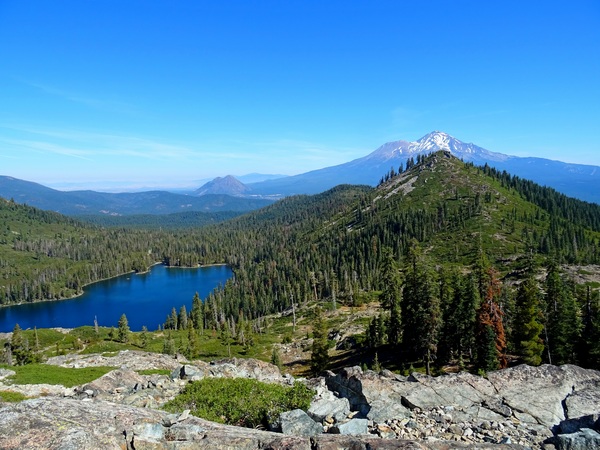
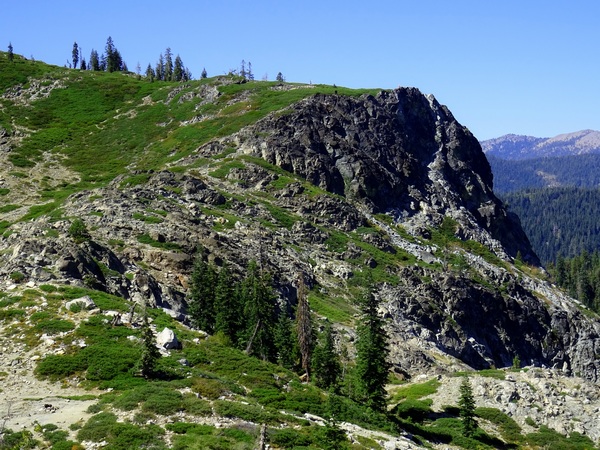
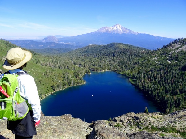
If you continue on past Heart Lake, you can walk up to where you can look right down on Castle Lake—right there at the right end of that green strip at the top of the photograph, right atop the rock cliff.
Were you to follow (with your feet) the green strip around to the left, you could semi-circle the back side of Heart Lake from a much higher vantage point. Were you to do that, you might get to some point from which Heart Lake does look very much like a heart.
But we didn’t go that far. Just to the point where we could look straight down on Castle Lake.
We were a mere five hours late getting into San Francisco, and somehow managed to check into our Redding hotel around 3:30 a.m. By 9 a.m. or so, we were in a rental car and on the road.
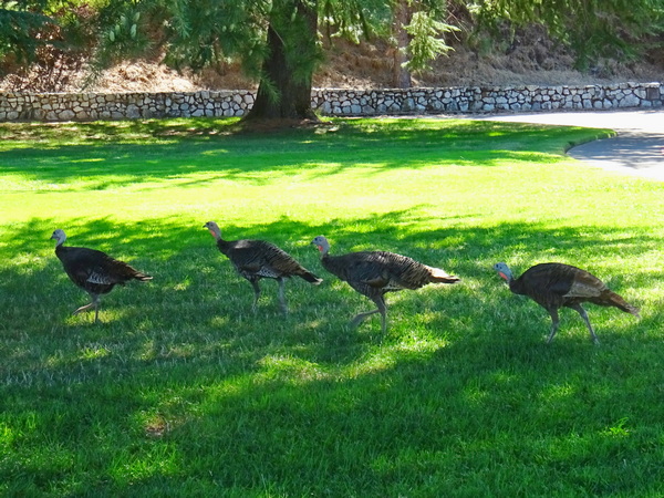
We made a quick stop at Shasta Dam . . .
. . . where nine (I think) turkeys strutted by, letting us know that we’d better not fall asleep in their back yard. Then we took two-lane Highway 44, heading west toward . . .
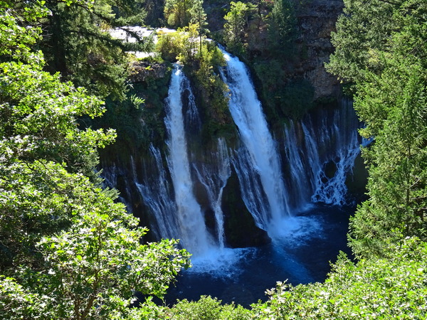
. . . Burney Falls, and amazing 120-foot waterfall on Burney Creek.
I’ll leave talk of Burney for another day.
By nightfall, we’d reached our little B&B in the old lumbering town of McCloud, got a good night’s sleep, and were up and ready for the 15-minute drive over to Mt. Shasta (the city), and Mt. Shasta, the mountain itself.
From downtown Mt. Shasta, it’s pretty simple. Turn right on Lake Street, heading east, drive by the high school, and then the road changes names—becomes Everitt Memorial Highway, the only road up the mountain.
A lovely drive, wouldn’t you say?
We stopped at the Bunny Flat trailhead for a bit of information, discovered that if you’re entering the “Wilderness” area, you need a permit, though the permit is free (you just take one out of the book and write down your name). The big map made it look to us like everything was in the Wilderness area, but we weren’t really sure. We got permits, just in case.
If you’re planning on climbing over 10,000 feet (we weren’t), you need a summit pass. That costs $25. The summit takes you up over 14,000 feet.
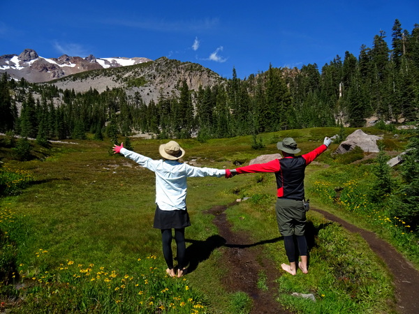
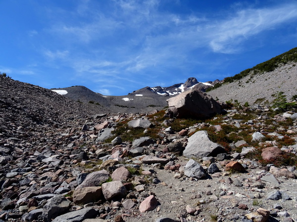
We drove on a bit farther up the highway to the Panther Meadows campground, at 7500 feet. We’d done some research, but because you can get to certain points from different starting places we were slightly (okay, quite) confused about the best route.
But to make a long story short, from the campground, we skirted Lower Panther Meadows on the Grey Butte Trail, turned left at the junction (right to Grey Butte, left to South Gate Meadows), walked to South Gate Meadows, climbed up to the spring, climbed back down, walked a different road back, to the Old Ski Bowl, and from there, walked down through Upper Panther Meadows and Lower Panther meadows, and back to the campground and our rental car.
It’s maybe four hours of easy to moderate walking. It took us about seven. Hopefully, the photographs will explain why.
We talked to several folks at the parking lot, trying to settle on the most interesting route, and finally ended up deciding to go the same way a very sweet lady in a sun dress and sandals was going. Yep, for many, it’s that sort of hiking. Us, we had on our regular hiking boots. Maybe more about that later.
The above shot is of Lower Panther Meadows. This is very sacred ground for the indigenous people. The signs say very clearly to stay on the single, narrow trail, and that seemed like a good idea to us.
There’s no church building, no man-made structure designed for worship, but for the indigenous people, hikers walking on the fragile plants that make up the meadow is no different from intruders breaking into Notre Dame Cathedral and taking a crowbar to all the stained glass.
Regardless of how much “sacredness” a person feels (though we certainly felt a lot the whole day long), the ecosystem is fragile. At least when heavy human beings comeonto the scene. A species that takes 40 or 50 years to mature can be stepped on and killed in a half of second.
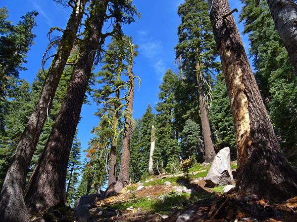
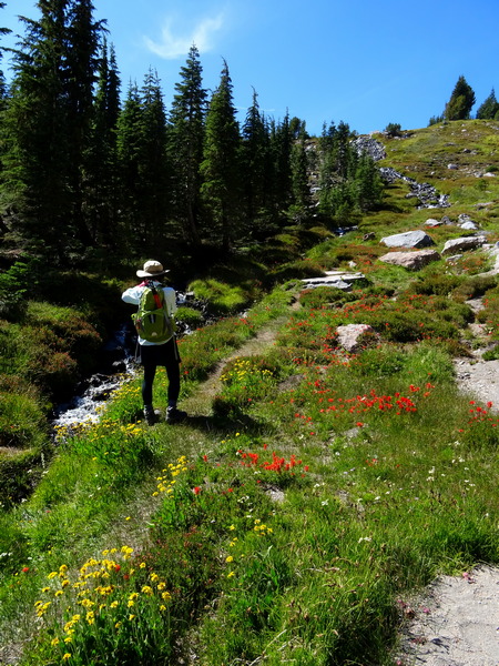
So we skirted Lower Panther Meadows and headed into the Red Firs and other conifers (we weren’t always sure what conifer was what) . . .
. . . and made our way along the Grey Butte Trail.
We were glad to have an informal guide. In sandals.
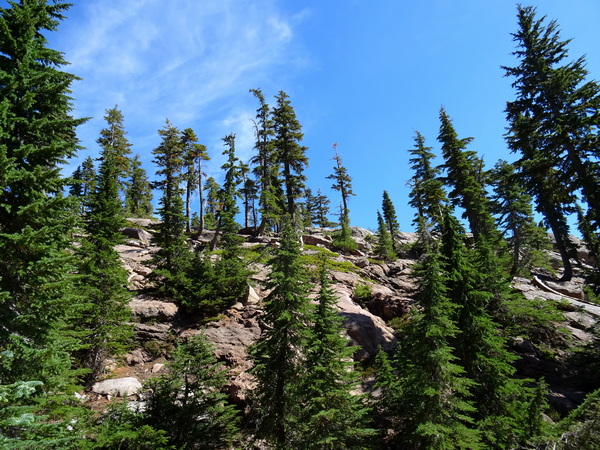
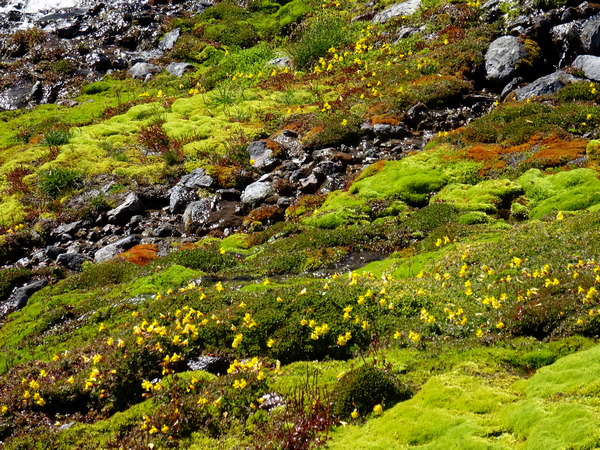
Once you’ve turned left at the junction and set your compass for the South Gate Meadows, there are generally less trees . . .
. . . and lots and lots of rocks. And even in September, at 8000 feet or so, here and there, patches of snow. There are also zillions of . . .
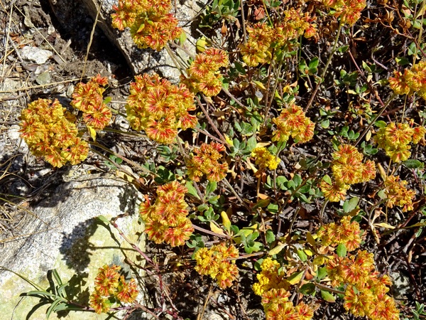
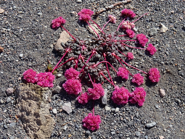
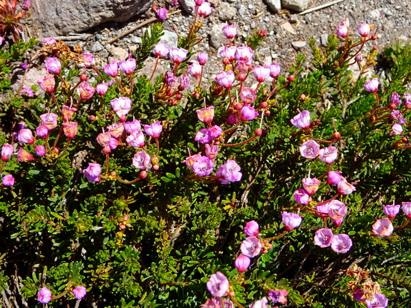
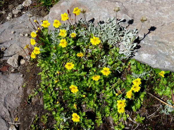
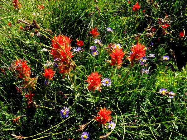
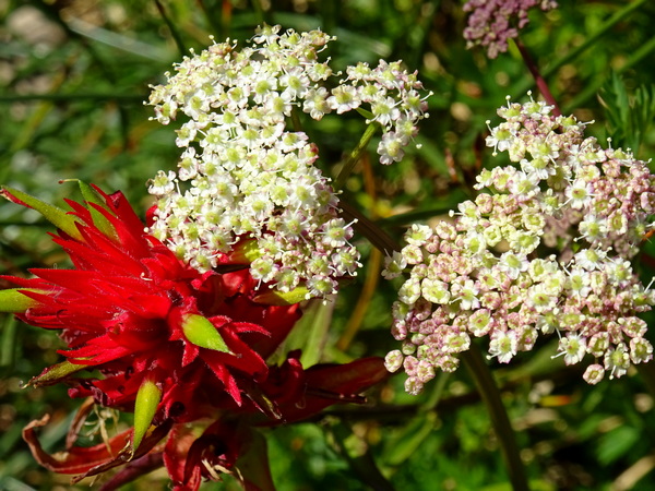
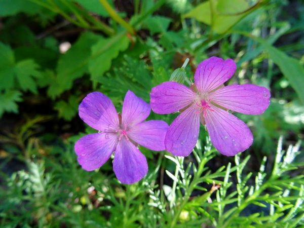
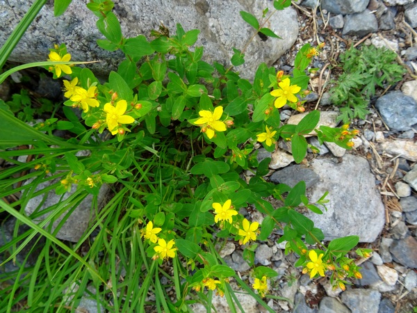
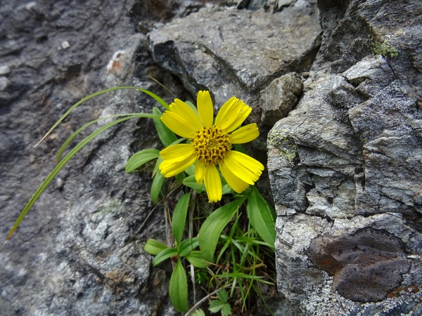
. . . wildflowers! The above flower, not surprisingly, is called Pussycat Paws.
I said “zillions,” but that is only a slight exaggeration. I’ve since downloaded an app for identifying “North California Wildflowers,” and if you just do a search for “wildflowers” in “rocky” areas, you’ll get over 1000 hits.
Of course, some only bloom at certain times of the year, but there were lots blooming in September.
Lots.
So lots of joy.
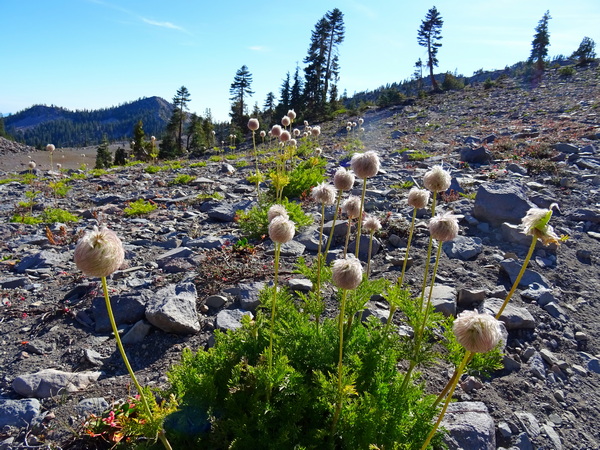
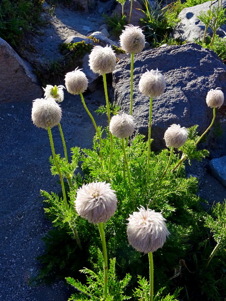
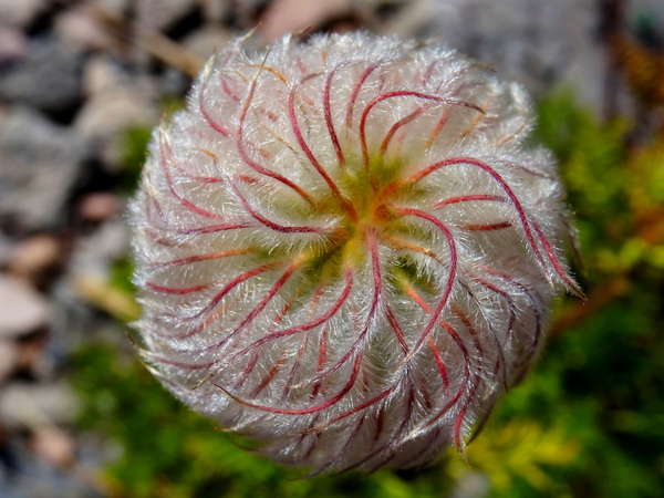
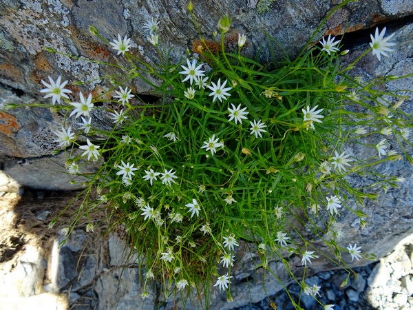
I didn’t find the name for every flower we came across, but did find names for the plants . . .
. . . that made my heart do particularly pleasurable cartwheels.
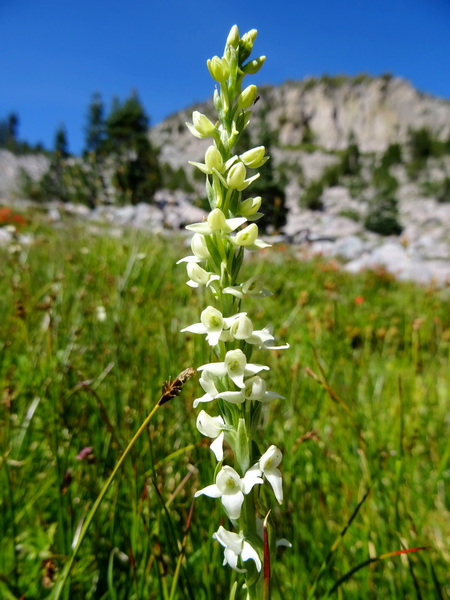
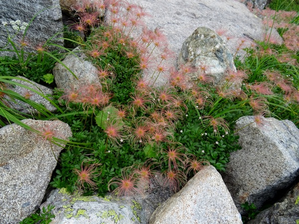
These are seedheads of a plant with relatively plain and small white flowers—the Western Pasqueflower.
I fell madly in love with them. Their spirals seemed too clever and too cute to be true.
But they were true. That’s the good thing about nature. You know that all it’s composed of is always true. No lying.
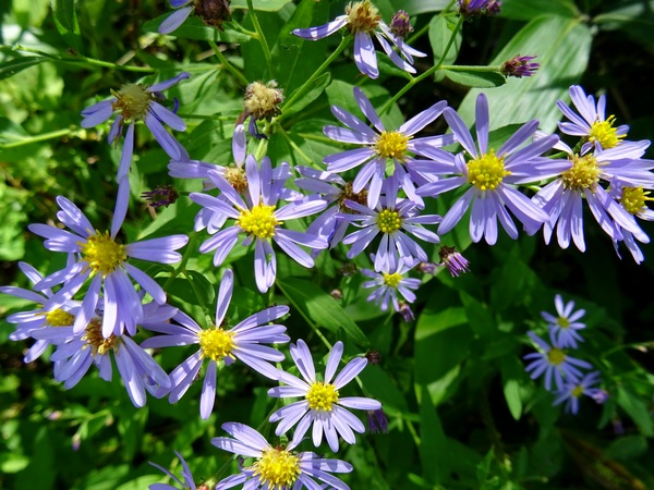
So it was a great walk through the rocks looking at all sorts of flowers that we’d never seen before.
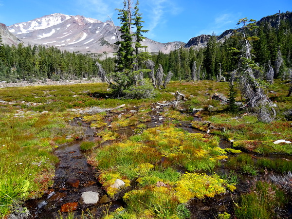
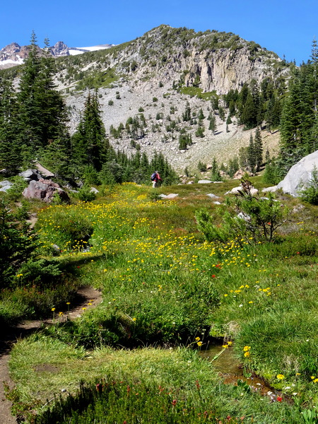
And then up ahead, we could see a strip of green. The strip got bigger and wider the closer we got.
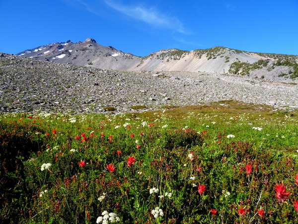
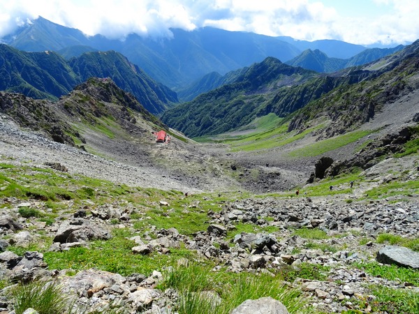
The South Gate Meadows!
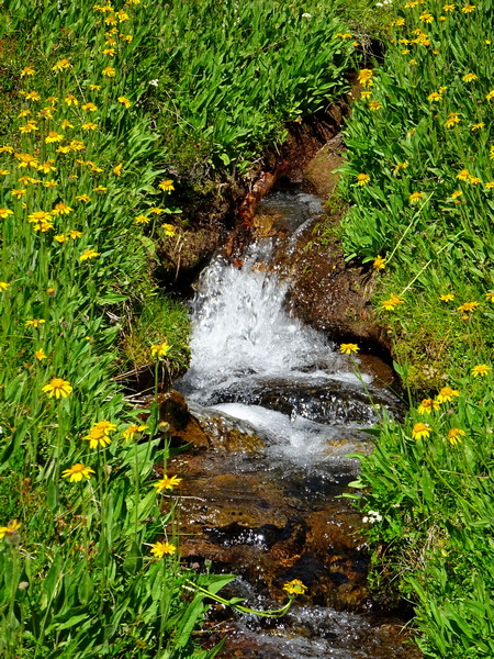
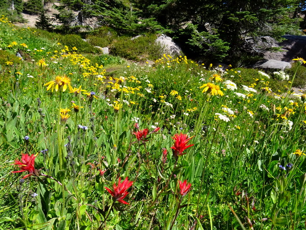
Flowers everywhere. A whole new set of flowers. Alpine meadow flowers.
Flowers everywhere, but they were especially thick, naturally, along the stream that flowed from the spring another twenty, thirty minutes up the mountain.
You may think I’m prone to exaggeration, but I sincerely hope you’ll believe me when I say—and I choose the word carefully—it was . . .
GLORIOUS!!!
The indigenous people believed it was wrong to climb to the top of Mt. Shasta. The summit was where the Gods lived. But the Gods at the summit had provided the snow, and the snow seeped into the mountain, and a bit down the slope the vast store of the mountain gushed out in amazing streams, and that water was a true gift from above (any way you look at it that has to be true), and you could walk up far enough to take of the water, and the meadow that sprung up in that place would feel as much a heaven on earth as any place could, and yes, you might just feel that the very spot you stood was the very spot where heaven and earth met, and you could sense certain metaphysical laws and truths, and those laws and truths would be spiritual in nature, too, and you’d seem to understand all that anyone ever could understand–but not through thinking–and you’d feel that what you understood–or rather, what you became aware of, was as much as you could ever hope to be aware of.
Yes, we got carried away, emotionally, standing there with the meadow and the rocky top of the mountain right before us, but I am not getting carried away with my language now. This is what we felt. Spontaneous feelings recalled in tranquility.
It was the best spot a living being could be, so we were in no hurry to leave. We stayed for about an hour at the bottom of the meadow. For about half that time, we were the only two people in sight.
We did, however, have a chance to talk with our guide a bit, there at the bottom of the meadow. About twenty minutes before we’d gotten to the meadow, she’d taken off her sandals and gone barefoot. To go easier on the land, she said, and also to feel the land.
This was easy for me to understand. I spent a lot of time barefoot as a kid, and recently, even with boots on, on a spongy trail, feel that the bottoms of my feet can sense what’s going on deep down in the ground, can feel how the roots of trees are gripping the dirt deep down. Anyway, we Hearty Hikers took our shoes off, too, and the moist ground by the stream felt really good.
Well, there are all kinds of climates, and all kinds of considerations, but it’s worth a few minutes of thought to ask ourselves how wise it is to keep our feet bundled up in shoes all the time we’re out and about in the world. A lot of things can be transmitted through feet.
All the flowers.
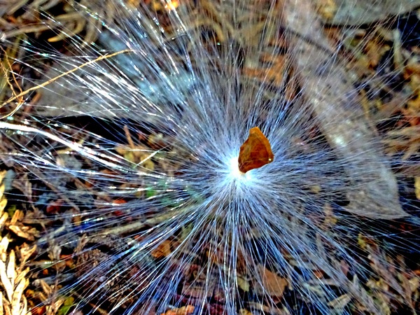
And the tortoiseshells. They were in migration. The sky was never thick with them, but there was a constant stream, a river, two or three or four them at a time, all on the exact same path, heading down toward McCloud, toward the heart of California, toward Mexico.
At last, we headed up the stream, heading for the spring.
Endless flowers.
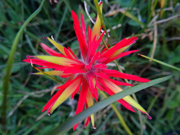
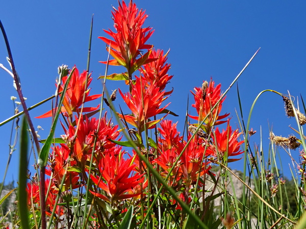
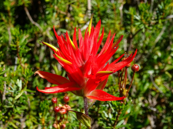
And this one, too, Indian Paintbrush, tickled my fancy.
The season, the red against the blue, the way the flowers clumped, reminded me of the spider lilies all over my neighborhood here in Shizuoka.
Some people, you know, say that Mt. Fuji and Mt. Shasta are connected in some way or another. I don’t know, but they do say that. There does seem to be some connection between the spider lilies and these paintbrushes. I don’t think such a similarity would have surprised Alexander Humboldt, the Prussian naturalist/geologist who’d crossed an ocean to cross the Andes.
Up, up along the stream we went.
Careful to stay on the thin trail.
And we just let our eyes devour all they could.
And then we were up to where the water came out from the ground, came out as a wide stream, came out streaming strong over the bed of rocks.
We climbed up a bit farther, stood just above the spring and looked up the mountain. I would have thought the hiker in me would have said, “Let’s go!” . . . but he didn’t.
This day we’d come as high as we needed to.
The first half back was along the same trail, but a trail taken twice is never the same both times. At the least, the light changes. Angles of perception change, too.
We turned off toward the Old Ski Bowl. Another rocky trail.
With the occasional spring, and a meadow, however small, flourishing along its waters.
The Ski Bowl trail brings you back to the Everitt Memorial Highway. And then a slight jaunt down the road takes you to the trailhead of . . .
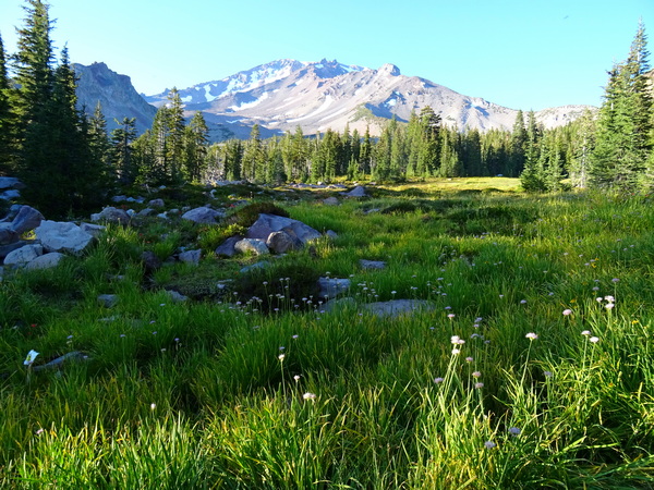
. . . Upper Panther Meadows. From there it is just a fifteen- or twenty-minute walk through the meadows (of course, on the trail) and back to where you left your rental car.
At the top of Upper Panther Meadows is, of course, a spring. This time, the spring is a pool a couple of feet deep. It reminded me of a private bathtub attached to an expensive room in a nice hot springs resort in Japan.
The bottom is sandy, and thus, it’s easy to “see” the water bubbling up from the bowels of the mountain.
And it’s quite a sight. And you can’t help thinking of all the good stuff that’s going on down there, down there in the Earth. I guess that’s a big reason why the indigenous people preferred not to dig down into the Earth, not if they could help it.
Yes, yes, of course, I tried to take a picture of that bubbling sand. But I couldn’t. Not a picture that would allow you to see what I saw. But that’s the way it goes. Sometimes, the most important things, you can’t capture them with a photograph.
It’s hard as hell to capture them with words, too.
(from Persimmon Dreams: When you’ve got a spare moment, check out our music/nature videos on our “Persimmon Dreams” YouTube channel, or Steve’s books, When a Sissy Climbs a Mountain in May and Along the Same Street, available on Amazon, or directly from us.)
We’ve had our breakfast at the Yarisawa Lodge (even took a HOT bath before hitting the sack, the first time ever in a mountain lodge here in Japan), and are ready to continue our walk from the resort town of Kamikochi to the tippy top of Mt. Yari’s spear-tip summit.
We’ve done the easy part, thirteen or fourteen kilos along the Azusa River and Yari Stream, gaining only a few hundred meters in elevation.
Now we’ve got six kilometers in distance and 1407 meters (over 5000 feet) in elevation change ahead of us. The lodge sits at 1773 meters. The tip of Yari’s spear rises to 3180 meters, making it the fifth tallest mountain in Japan.
We figured it would take us about five hours to get to the Yari ridge, and another thirty minutes to scramble up to the tippy top.
Some folks (folks with more energy than we (or I) have) take in both Mt. Yari and Mt. Oku-hotaka (the third tallest mountain in Japan at 3190) in a single hike, but that requires 1) walking a lot farther each day, or walking for five days instead of the three we had, and 2) crossing the famous, perhaps notorious, “Dai Kiretto,” which roughly translates as “the super jagged ridge that requires careful three-point (two hands, one leg or two legs, one hand) advancement, sustained for three hours, with any mistake meaning a long, long fall–most likely the last fall for you.” This “Dai Kiretto” is well-known as the most difficult bit of non-technical mountain climbing in Japan. If you’re scared of heights, or the weather is not so good, you definitely want to avoid it. If you want to consider it, you might consider a guide your first time, or at least going with someone who’s done it before. And you want to be extraordinarily careful. People have lost their lives here.
But like I said, that wasn’t part of our plan. Not this time.
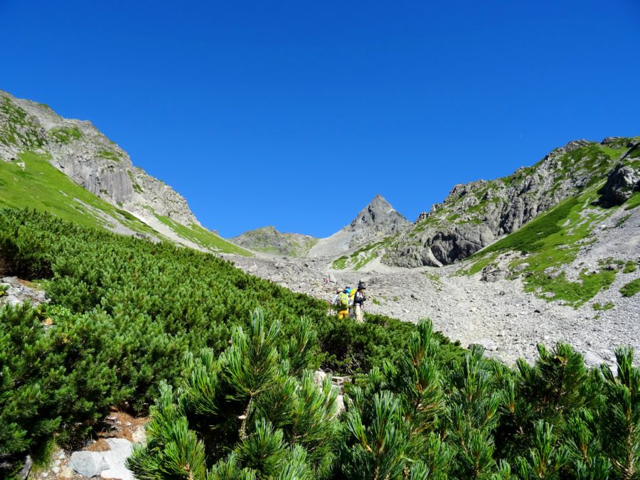
So back to the matter at hand. The day’s walk up from Yarisawa Lodge to Mt. Yari. The first couple of hours are a gradual incline along the Yari Stream, gradually winding into a cirque of mountains. Along the way, there are plenty of streams from which you can fill up your water bottles.
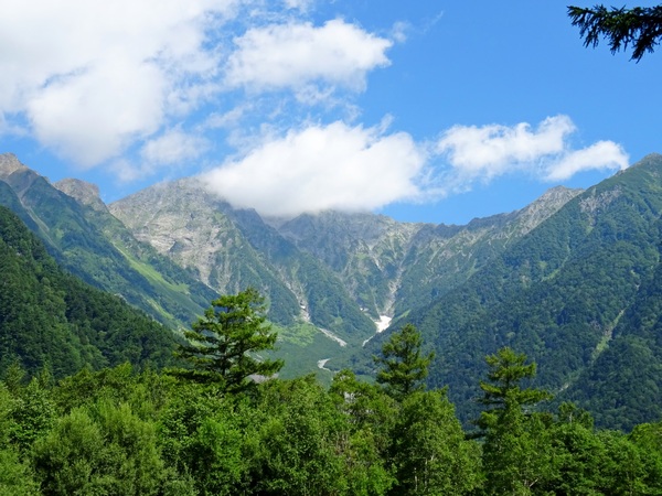
Then you come around a green slope, and for the first time on your day’s walk, see Mt. Yari rising up into the blue. This view is just after you cross the last stream on the walk, so here, make sure you have enough liquid for the remaining couple of hours. (Of course, the amount depends on the temperature.)
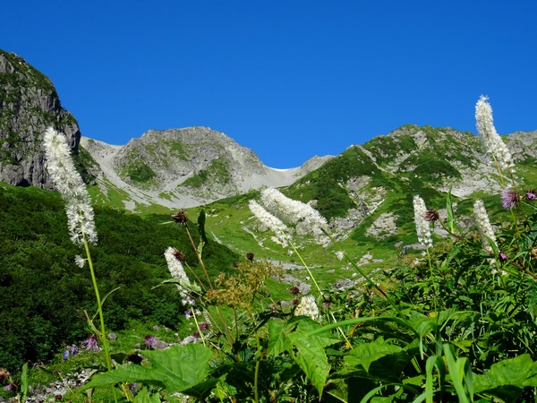
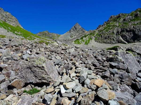
And up, up, up you go. The trail gradually gets steeper.
And rockier. Basically, it’s not a difficult trail, only steep. The trail itself gets a bit rocky . . . though the rocks in the picture above are offtrail.
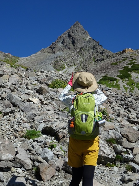
You’ll surely want to take a lot of pictures, especially if you have a sky like we did, but taking a lot of pictures won’t make Yari get any closer.
Most likely, you’ll get tired. So make sure you’ve given yourself enough time to take a breather now and then, to slow down your pace as necessary.
And of course, enjoy the flowers.
Chinguruma. (After the blossoms have disappeared.)
Almost to the ridge. In the end, what we thought might take about five hours took us four and a quarter. We tend to go a little faster than average course times going up, and about right on course times going down.
Balky knee.
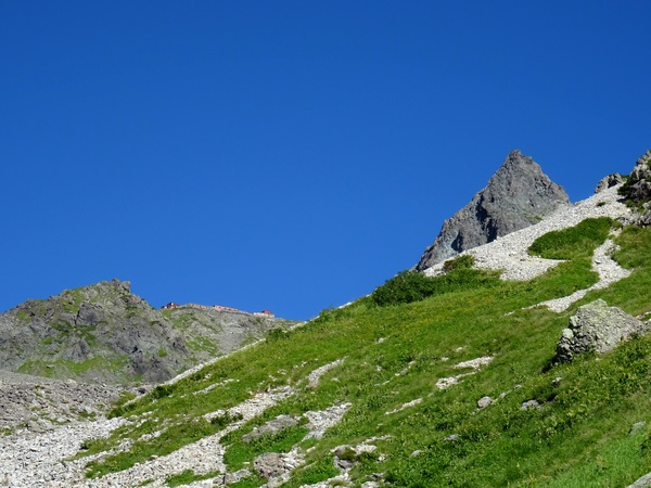
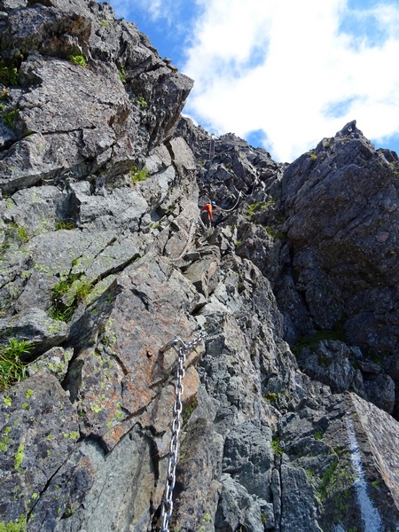
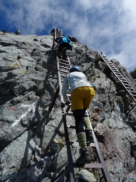
And then we hit the ridge. All that was left was the thirty-minute scramble up to the summit. Below is what the view looks like when you’ve gotten a few minutes up the spear.
Yes, yes, you have to cling to chains and climb up ladders, and make sure of every step, but when you’re actually doing it, well, I think most people don’t feel a strong danger. But you do need to be careful.
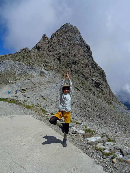
Up our Hearty Hiking leader goes!
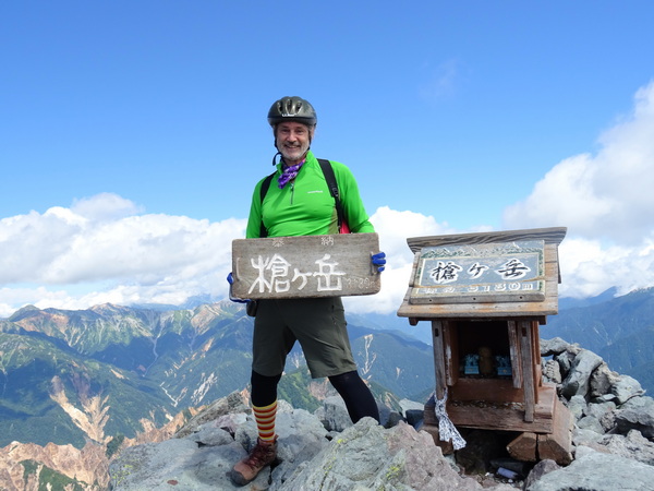
And then up I go. Up to the tippy top.
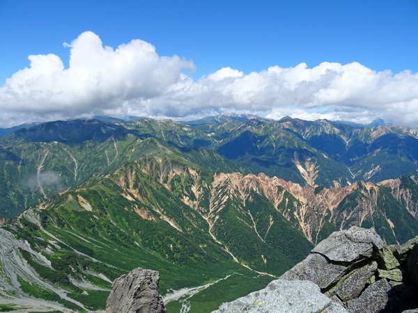
How lucky to have such a lovely view!
It’s the top of a spear, and the highest point in the area, so of course there is a 360 degree view.
Fog was just rolling into the space we’d just walked, but the far side was clear as could be.
You can feel how the mountains were formed.
Or as a good friend of ours once said:
The first in time and the first in importance of the influences upon the mind is that of nature. Every day, the sun; and, after sunset, night and her stars. Ever the winds blow; ever the grass grows. Every day, men and women, conversing, beholding and beholden. The scholar is he of all men whom this spectacle most engages. [. . .] Classification begins. To the young mind, every thing is individual, stands by itself. By and by, it finds how to join two things, and see in them one nature; then three, then three thousand; and so, tyrannized over by its own unifying instinct, it goes on tying things together, diminishing anomalies, discovering roots running under ground, whereby contrary and remote things cohere, and flower out from one stem. It presently learns, that, since the dawn of history, there has been a constant accumulation and classifying of facts. But what is classification but the perceiving that these objects are not chaotic, and are not foreign, but have a law which is also a law of the human mind? . . . Ralph Waldo Emerson
After coming down, our dear leader was feeling, shall we say, full of joyous energy.
Below is the view of what we’d climbed up.
Well, it was only about 11 a.m. We had a choice. We could spend the night on the Yari ridge, in the Yari ga take Lodge, and walk the entire twenty kilometers back to Komachi the next day . . . or we could head back right then, get back to the Yarisawa Lodge by three or four in the afternoon, spend one more night there, and have a more leisurely (five, not nine, hour) walk back to Kamikochi. We chose the latter. Which meant this second day would come to about nine hours of walking/climbing in all.
Yes, yes, it tuckered me out. But we made it back down to the Yarisawa Lodge safe and happy.
This yellow fellow reminded me of that single flower that blossoms outside Hester Prynne’s prison cell.
The view going down.
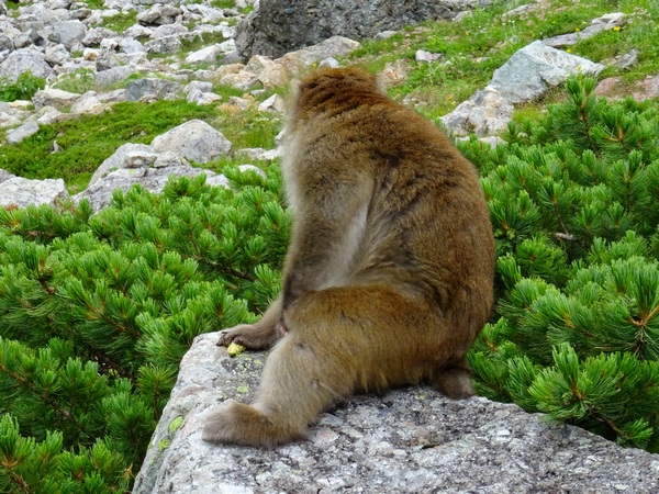
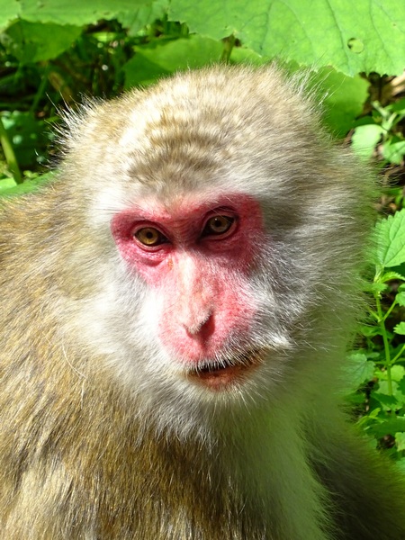
About halfway down, this monkey popped right out from the shrub pines, about three steps from me, and sat on this rock. He seemed to be wondering what we’d been up to. Had we really walked up to the ridge, then climbed the spear, just so we could scramble back down?
Yes, we had.
(from Persimmon Dreams: When you’ve got a spare moment, check out our music/nature videos on our “Persimmon Dreams” YouTube channel, or Steve’s books, When a Sissy Climbs a Mountain in May and Along the Same Street, available on Amazon, or directly from us.)
We had some flexibility with the days we could get out of Shizuoka, so we patiently waited for the weather forecast to improve, then on August 25 drove the three hours to Nagano, parked, and caught the bus into Kamikochi, for a three-day hike up and down Mt. Yari.
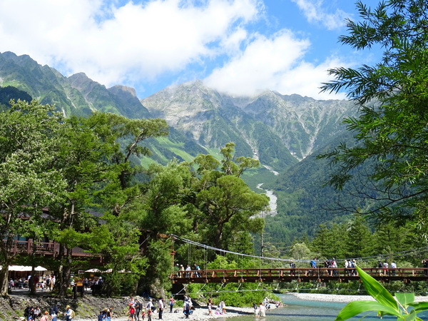
Kamikochi is a tourist haven, but it’s also the jumping off place, for as many different hikes for as many days as you can imagine up into the Hotaka mountain range (above), Mt. Yari, and lots and lots of other mountains in the area. Also, above, the well-known Kappabashi Bridge, souvenir shops on both sides.
Just walk a bit farther, though, fifty meters or so, look out at the same view, and there’s a different atmosphere. Now there’s just you . . . and the long walk ahead of you.
To the top of Mt. Yari and back is approximately 39 kilometers, with an altitude climb of 1675 meters. Our plan was to walk as far as Yarisawa Lodge (thirteen or fourteen kilometers, but only 200 meters or so up , about five hours according to average trail times), then climb the last six kilometers in distance and 1400 meters in altitude the second day.
Anyway, the first day of hiking was all along the river, crossing lots and lots of side streams and . . .
. . . through the woods.
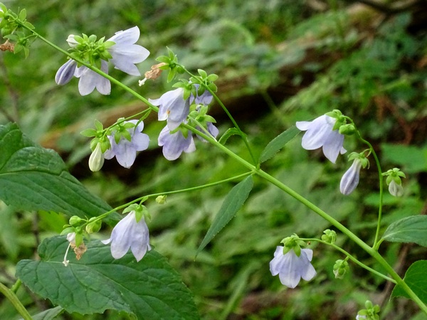
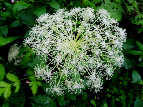
Of course, one of the joys of such an Alpine hike is the host of flowers you come across along the way.
Go ahead. Stop. Snap a few pictures. Smile.
We needed to be at the lodge by about 4:30 PM. We’d started about 10:30. We had plenty of time. If I have any advice, it is this: make sure you have enough time to stop and look at things. There arelots of things out there.
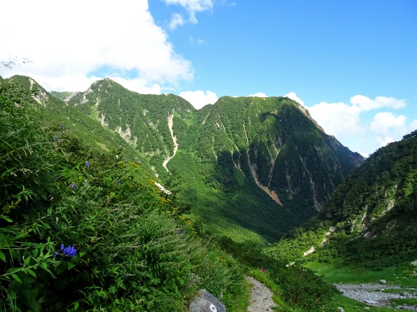
From time to time, the view opens up on your left. Above Mt. Myojin, a sacred mountain . . . though of course, they’re all sacred mountains.
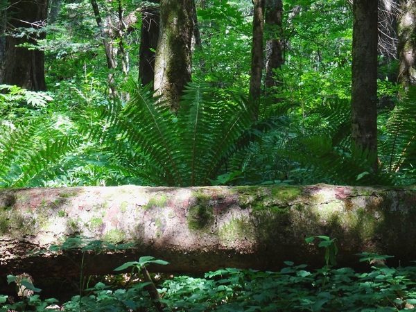
“Composition in log and fern.”
Spent a bit of time playing around with shutter speed. Actually, the above shot was taken on our third day, coming down. On the first day, the sun was too bright to take a good picture here.
山母子 Yamahahako
There’s not an English name for this flower, as far as I know, but the Japanese translates as “Mountain Mother and Child.”
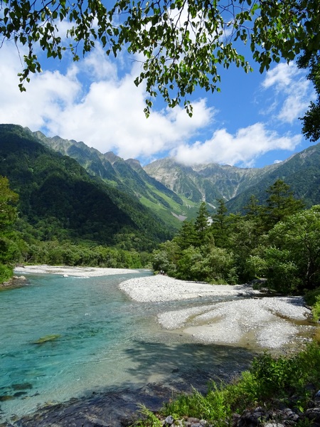
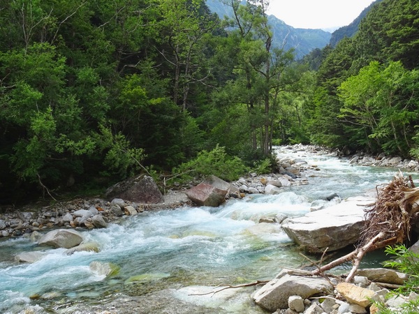
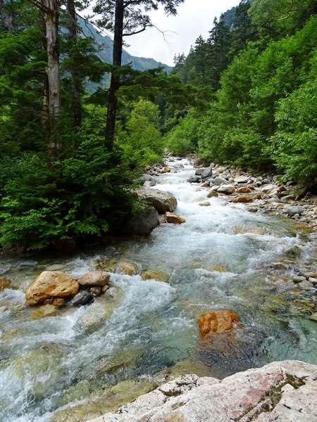
Upstream its called “Yarisawa,” the Yari Creek, or Yari Stream, downstream when its bigger, “Azusagawa,” The Azusa River.
About sixteen or seventeen of the nineteen kilometers to Mt. Yari, you’re walking along this water.
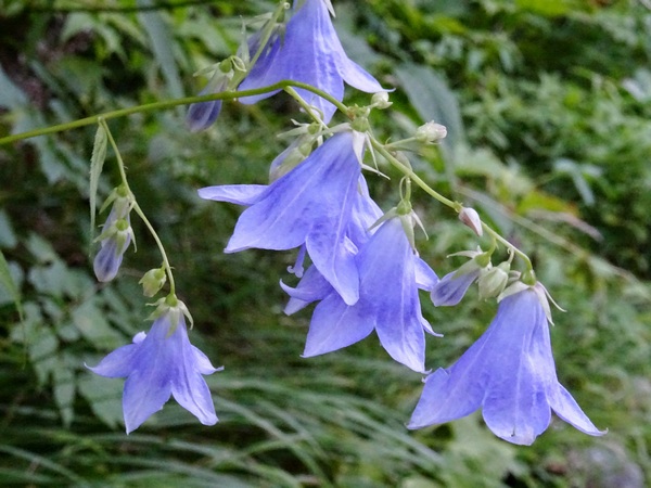
Sobana
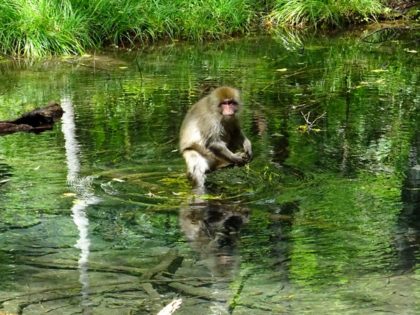
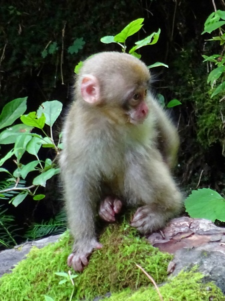
What’s this? A monkey? A monkey in a green pool?
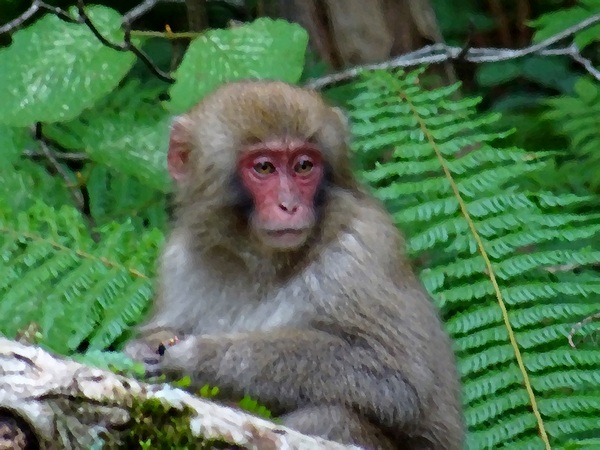
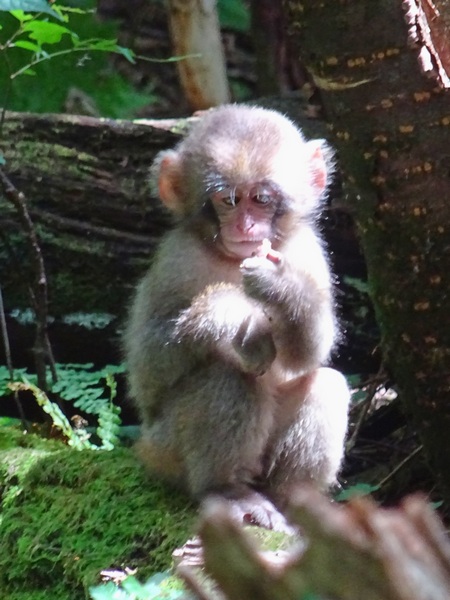
This was the first monkey we saw, but before we knew it, we realized we were in the midst of seventy or eighty, on both sides of the trail.
Twenty minute delay. To watch the antics of the little babies. To study communal grooming techniques. To discern attitudes.
Torikabuto (Monkshood)
The clear water of the stream, the orange of the rocks, the blue tint, how all that refreshes your soul. I’m going to get my Hearty Hiking partner to write a tanka poem about that.
シラネセンキュウ(白根川芎) Shiranesenkyu
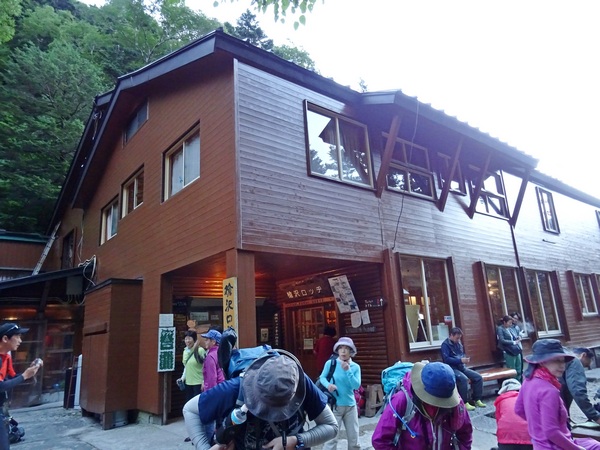
Finally, the Yarisawa Lodge, up about fifteen meters from the river. We got there in under five hours, and that with a lot of time spent with the monkeys and flowers, a lot of time playing with the camera shutter, a lot of time just listening to river–and breathing deep.
In the morning, up to Yari!
(from Persimmon Dreams: When you’ve got a spare moment, check out our music/nature videos on our “Persimmon Dreams” YouTube channel, or Steve’s books, When a Sissy Climbs a Mountain in May and Along the Same Street, available on Amazon, or directly from us.)
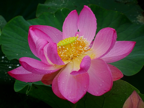
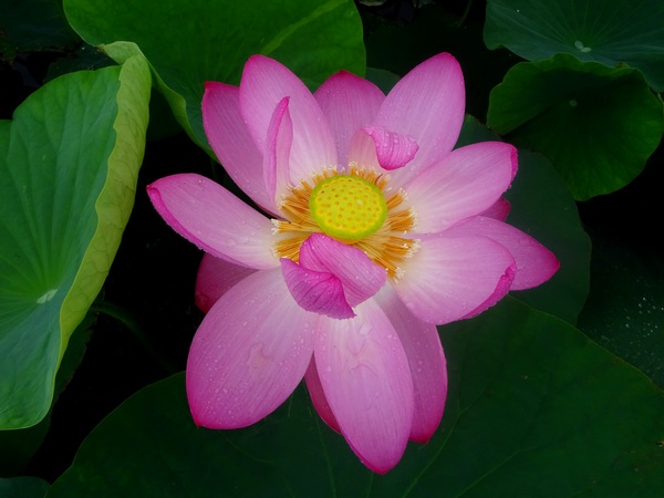
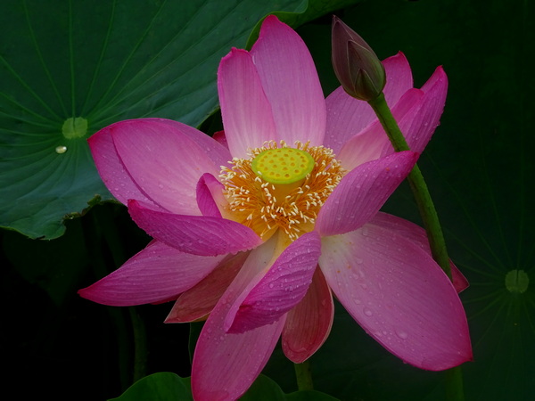
So happy to have a lotus pond in the neighborhood. And the blossoms are just beginning. A lot of joy to look forward to this summer.
The excerpt below is from When a Sissy Climbs a Mountain in May, to be published early July, 2019. The narrator is a songwriter . . . of sorts!
The lotus flower's veined pink skin
Is lit up bright from within.
You have to stop and feel amazed--
It doesn't burn but stays ablaze.
Eyes are ears and ears are eyes,
Helping us to empathize.
Paradise is what you feel,
And what you feel is all that's real.

Who's your enemy? Who's your friend?
When will this talk ever end?
For 2000 years we've wondered hard--
Now we can't play any card.
Paradise is what you see,
What you see is all you need.
Just your eyes can make you kneel,
'Cause what you feel is all that's real.
For more information about When a Sissy Climbs a Mountain in May, visit us at Persimmon Dreams Press.
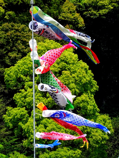
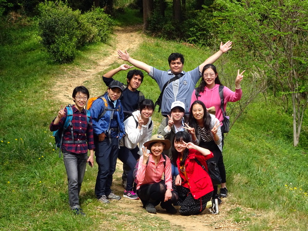
April 20. Some of the members of our international club at Shizuoka University, YASHIO, gathered at Gokoku Shrine in Shizuoka City to hike up the intown mountain Yatsuyama, all 108 meters of it. Only 108 meters, but we climbed, we felt joy breathing in air at the top, and we were able to look out over the ocean and the city–so of course Yatsuyama is a mountain. No question about it.
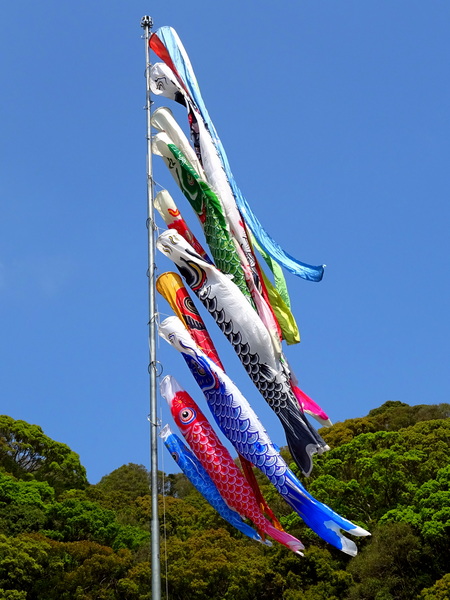
Eleven of us went. It’s hard to manage a hike with so many people with so much different experience hiking–so I was so happy that we could find the right pace–and that everyone could have a great time. In many ways, we were a lot like the flying carp at Gokoku Shrine, all different colors, flying here and there, but somehow all together.
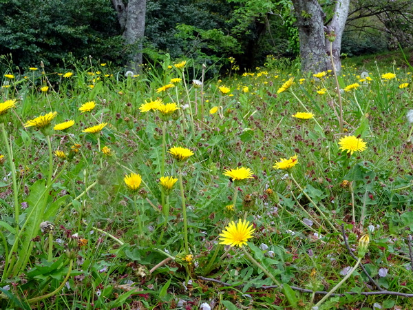
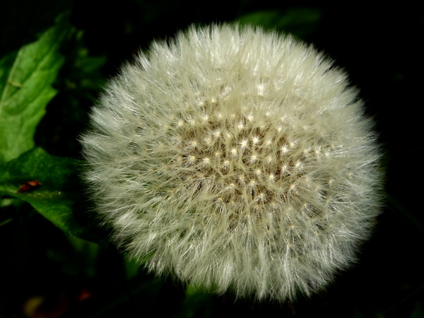
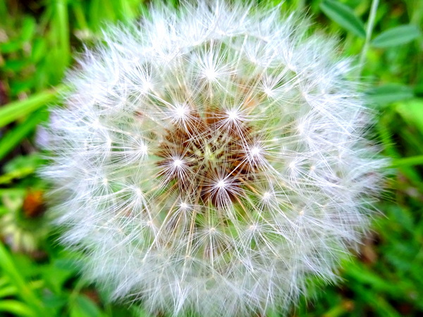
Or maybe like the dandelions. Just out in the fresh air, enjoying the day, feeling blessed in a simple sort of way.
Pretty happy I’d say, wouldn’t you? This day, we were from Japan, China, and Indonesia.
And the cameraman, moi, representing the Western Hemisphere.
When you’re happy like this, it does something to your eyes. You see better.
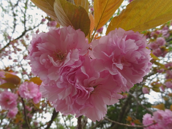
Cherry blossoms.
Some hikers thought the cherry blossoms resembled a heart. One thought they looked like the face of a praying manus.
We’re lucky to have in Shizuoka so many varieties of cherry trees–they all bloom at slightly different times, making for a long and glorious season.
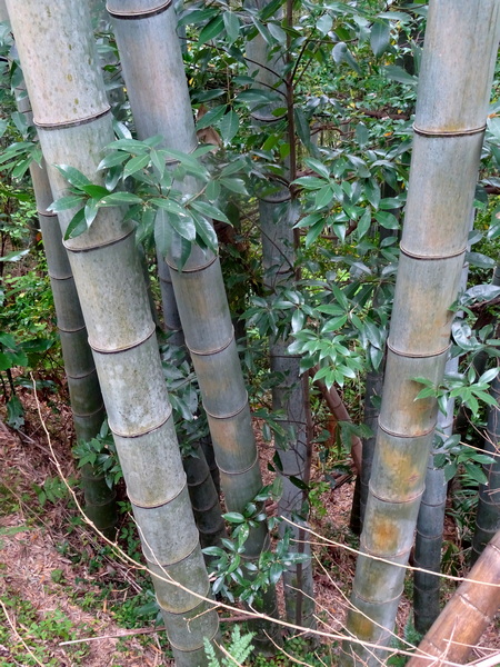
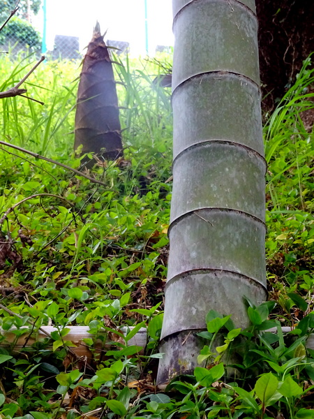
The bamboo forest.
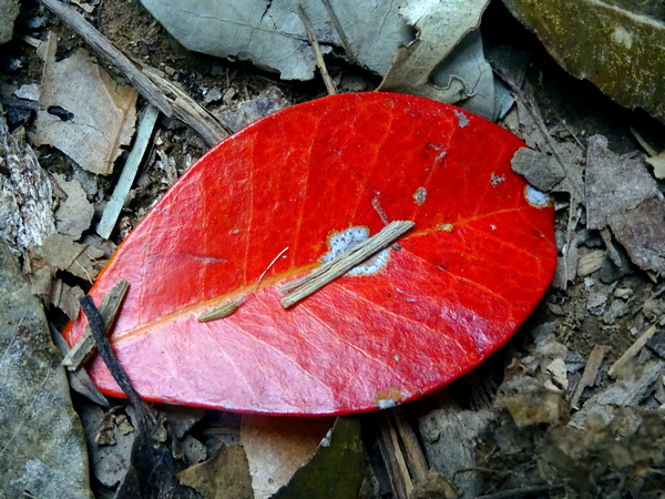
The moon.A red leaf at rest.
Flying flower petals.
Mama-Papa bamboo and baby bamboo.
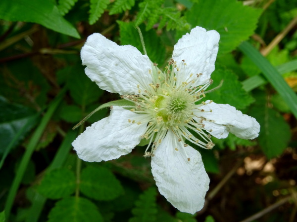
A strawberry flower.
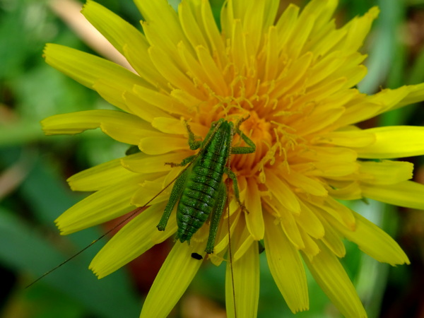
Happy grasshopper.
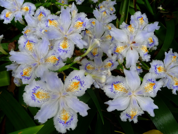
A bed of shaga flowers, at the foot of the mountain, near the shrine.
Some creatures may know more than you first imagine they do.
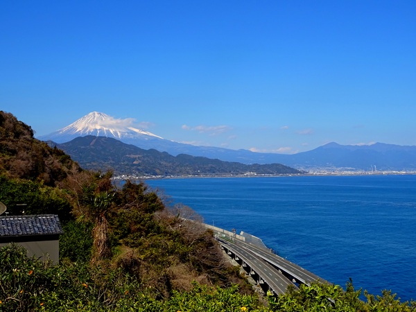
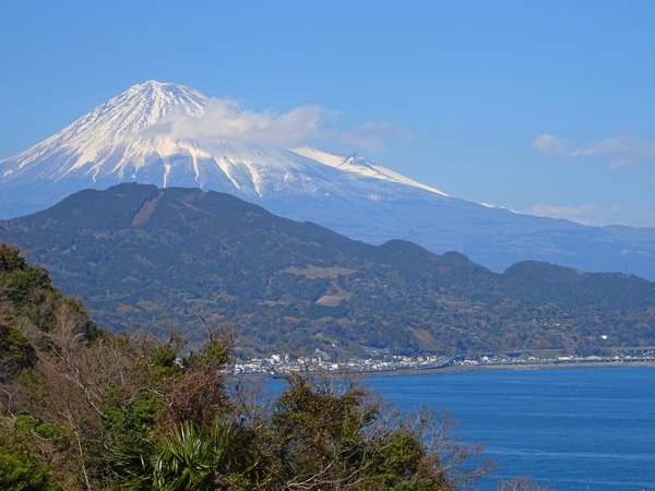
March 24. A hike up Hamaishi, 707 meters, a mountain which comes face-to-face with Mt. Fuji.
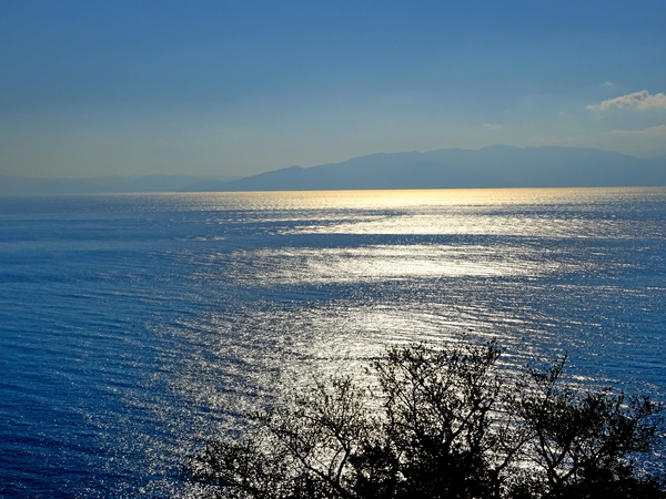
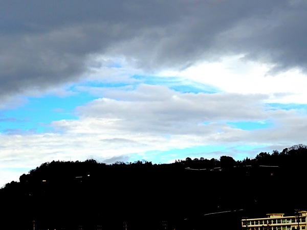
It’s very convenient. From the heart of Shizuoka City to the parking lot near the Satta Pass trailhead, it only takes about 30 min. by car. You can also take the train and get off at Yui Station, though in that case, you’ll have to walk/taxi to the Satta Pass parking lot or nearby.
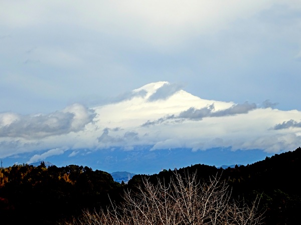
The picture above was taken from the parking lot, which is already about 100 m above sea level. That leaves you with about 600 m to climb.
The distance to the top is somewhat of a mystery. The navigator on our Hearty Hiker team concluded that our round trip was a total of 13.7 km, but the sign posts all along the way suggest it’s significantly longer. Me, I trust our navigator. For sure, the time estimates on the sign posts are out of whack. The average hiker doesn’t take nearly as long as they indicate. This day we walked about six hours, I think.
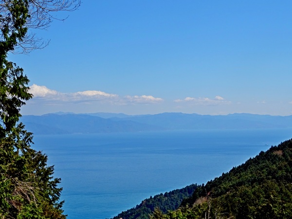
The appeal of this hike, besides the ease of getting to it, is that you have, if it’s a clear day, great views of Mt. Fuji, great views of the Umegashima mountains and the southern Alps beyond, and . . .
. . . great views of Suruga Bay and the Izu Peninsula.
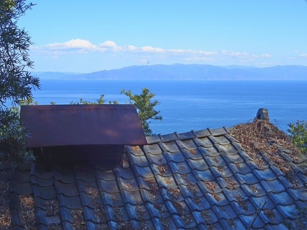
You walk along about 15 min. from the parking lot before you see your first trail signs and actually turn off from the pavement. You’ll soon walk behind this old shack. I love the view of the bay as seen over its slumping roof.
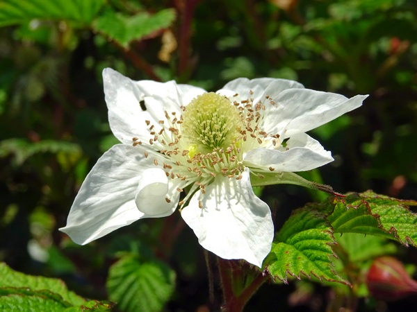
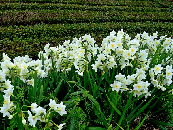
It’s also a good walk for spring flowers, though March is still a little early. The strawberry flower above was one of the few we saw. In three or four weeks, though, there should be lots here and there.
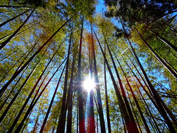
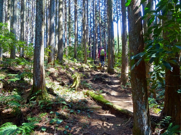
You pass through a bamboo thicket before you get into the cedar/cypress forest. Nice.
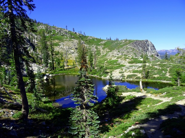
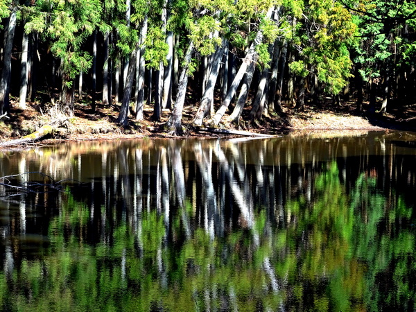
Once you’ve walked through the cedar/cypress forest a ways, you’ll be tempted by a sign suggesting you take a detour to the Tachibana Pond. If you’ve got the time, give in to the temptation. It’ll cost you 30 min. or so. The pond sits in a low spot, with evergreen trees rising all around, and the reflections (we were there about ten a.m.) are very pleasing to the eye.
The pond is less a mirror, I felt, and more an Impressionist painter. Maybe as our human eyes tend to be.
Although you’re never far from the ocean, there are not many views of it once you’re in the woods. There is a bit of up and down along the way, but most of the trail, as you can see, is fairly easy walking. Including our detour, it was just a smidgen over three hours from the parking lot to the summit. (Signs say 4.5 hrs.)
One of the few places where the trail bent over to the edge of the ridge and the ocean view opened up.
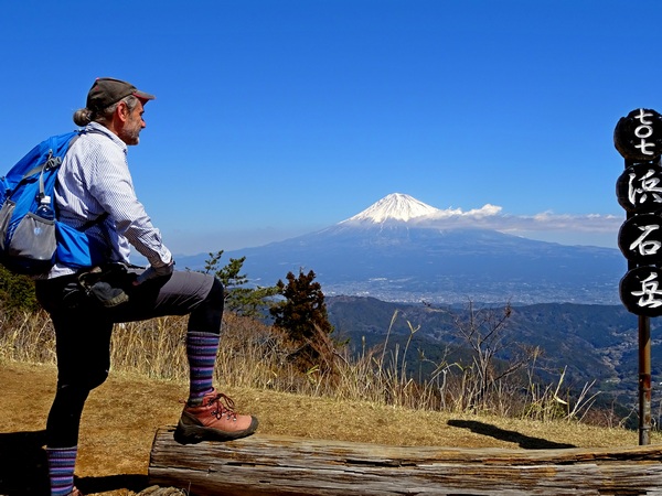
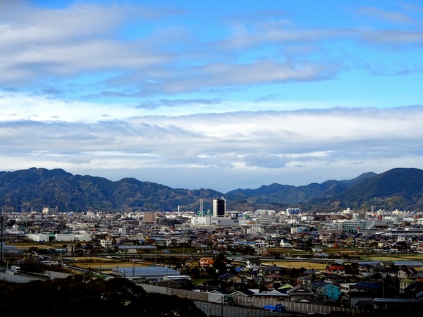
And then the summit. Nothing between you and Fuji. Nothing at eye-level, anyway. Nothing but good-breathing air, that is.
It’s a good spot from which to take in the lie of the land, to see how Mt. Fuji slopes down to Fuji City and the bay. Fuji City is where everyone in the bullet train is taking a picture of the big symbolic mountain with their i-phones. Turn your head to the left and there are the southern Alps. Come in mid-April or thereabouts and that bare-branched cherry tree will be sporting pink ribbons and bows. It’ll provide a splendid canopy for a picnic.
You can’t see it in the pic above, but there is an offshoot of the main trail that runs just behind and below the cherry tree. If you find your way onto it, you will see the pine tree below.
He is worth a close examination. See his trunk pushing down into the bottom, right-hand corner of the pic? Follow it up and see if you can see all the twists and turns it takes.
It’s pretty clear his message: No matter how complicated a childhood you may have had, you will (if only you keep your inner nature alive) eventually grow strong, sense the path you were meant to be on, and shoot up straight for the light.
On the way back, try to keep your eyes alert. No, not many flowers are blooming now, but just look at this little seed. He felt a bit unsure if he could reach his distant destination, so he asked his parents for a bit of help. Look at the vehicle they manufactured for him! Amazing.
March 9th. It had been a bit warm, but there’d been lots of rain and it was hard to gauge, beforehand, just how cold it remained in the mountains . . . so we Hearty Hikers had thought we might get one more chance to walk across the gentle Aozasa ridge in the snow.
But it was not to be. A bit of frost remained on the trail, here and there . . .
. . . but no snow.
No snow to glide through.
There was, however, a lot of snow on Mt. Fuji—and a beautiful blue sky. And when Fuji smiles at you, under a big blue sky, you can’t help but tingle and smile back.
In my new novel, When a Sissy Climbs a Mountain in May (scheduled release late spring/early summer 2019), the narrator meets a woman and falls in love at first sight. Then it’s autumn, and the two of them are relaxing beneath a persimmon tree. The narrator’s brought his very own baby persimmon tree, just a few weeks old, to show her. He’s an odd fellow, all right, but give him a break—he’s coming out from a dark, dark place. Anyway, he tells us . . .
We lay side by side looking up, the baby tree at our feet. We saw the same thing—the love coming through the blue, the warm glow of the orange.
I’d turn towards her, and she’d turn toward me and smile—and I would tingle.
What do you call a smile that makes you tingle?
A smingle? SMINGLE seems a pretty good word for the phenomenon, so SMINGLE it is.
Fuji-kun was not the only smingler this day. We Hearty Hikers, as you can see . . .
. . . brought our own.
And to be honest, in the end it was hard to tell who was smingling whom—and who was smingling more. The blue sky, Fuji-kun, and . . . . . . our own lovely Hearty Hiker, were all smingler and smingled, all at once.
The day became, believe me, a true smingle fest.
And I would say (albeit from in my very limited experience) that there are not many things better in this old vale of tears than a good smingle fest. Actually, I can’t think of any. Not at the moment.
Those guys in NDuaDuo were there with us, too, and they were so impressed by all the smingling going down that they started singing right there and then—I love to see you / Smile / Smile like you do / Your eyes / Always say / Something so true. They went home that night and recorded a new song. A first cut, they say. I’ll paste it in down below. Give it a listen if you’ve got the time.
But I guess we’re going to have to give the Top Smingler of the Day award to our beloved and trustworthy friend, Fuji-kun.
He smingled us from beneath branches big and small.
He smingled us through circles of branches.
He smingled us through circles of trees! He perched himself high in the sky and smingled us through a winter-branch garland.
And yes, even through the clouds that inevitably rolled in. On a day with so much smingling, you don’t have to think twice about showing a little gratitude. Thank you, Jizo-san.
February 2, 2019. A clear and warm winter’s day. A beautiful day for a snow hike.
From my place in Shizuoka City, about a 45 min. drive to the town of Utogi, famous for its wasabi, and another 15 min. to the Aozasa trailhead. Actually, there are two trailheads, one at Aoi Kogen, and another farther along the mountain road, one that leads directly up to the Jizo Pass.
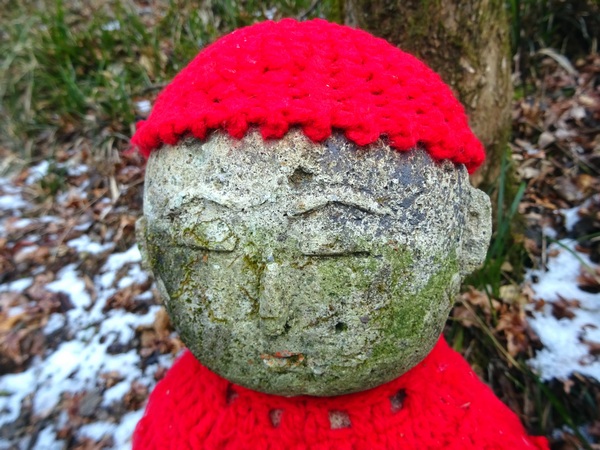
If you drive six or seven minutes past Aoi Kogen and get to a place where it looks like a couple of cars could park . . . and red-coat Jizo is there to greet you, then you know you’re where you’re supposed to be.
From the “Red-coat Jizo” start to the Jizo Pass, it’s a 30 or 40 min. walk–this day through the snow.
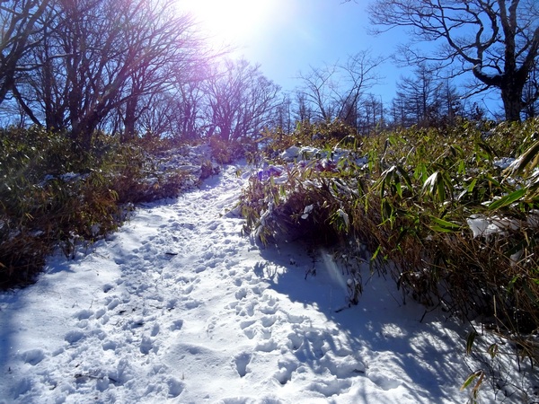
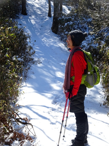
We love to walk in the snow. We went to walk in the snow.
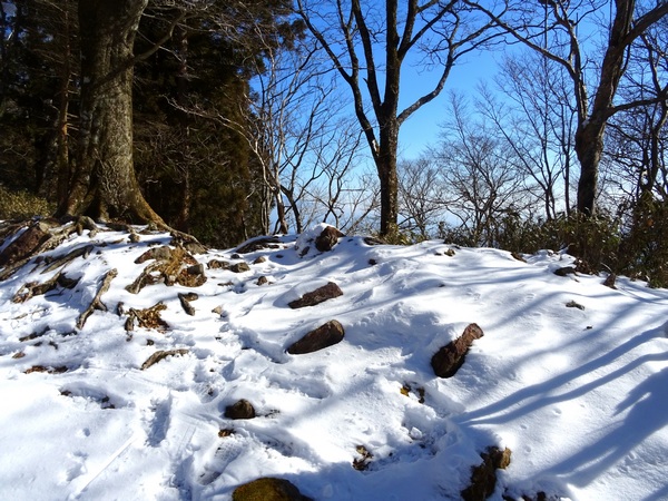
Reaching the Jizo Pass.
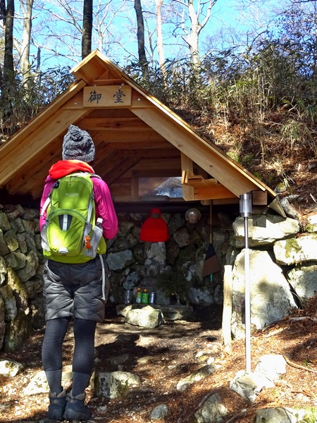
There’s a hut at the pass, with another Jizo inside. Someone’s left him some drinks, and a bit of change, and he looks pretty content.
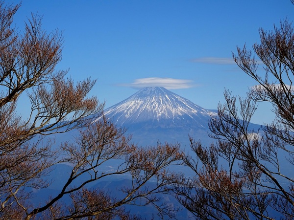
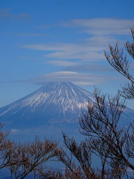
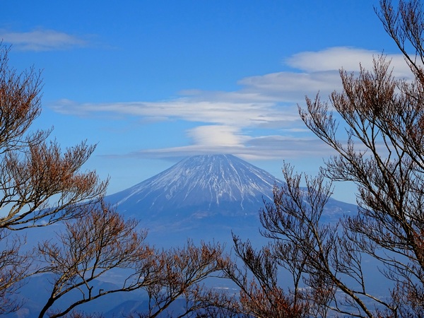
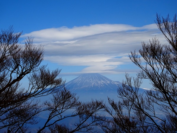
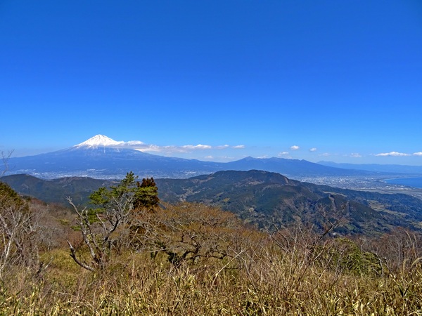
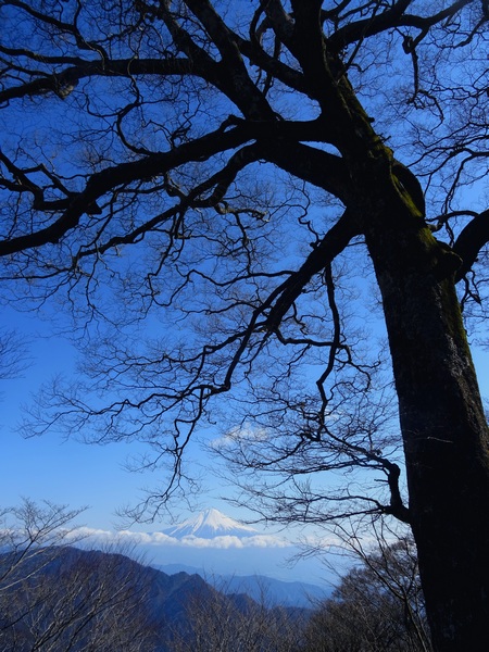
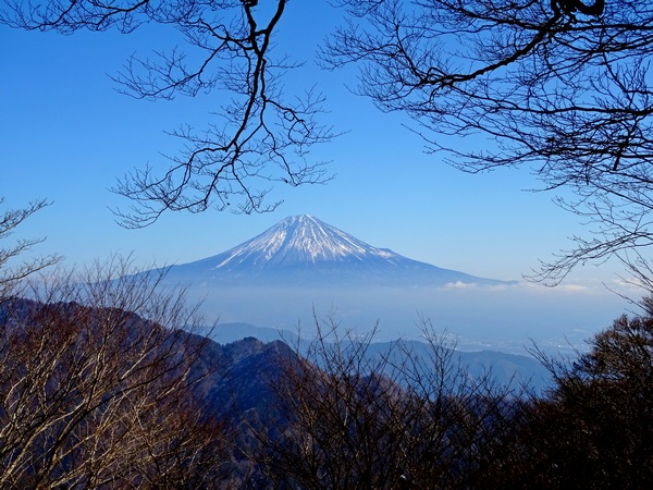
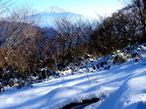
A few minutes up from the Jizo Pass, along the main Aozasa Mountain ridge, is one of our favorite Fuji-san viewing spots. The photograph at the very top of this blog post is from this spot, too.
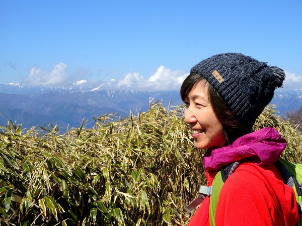
From the Jizo Pass to the top of Mount Aozasa, it’s an hour and half or so. It might take a little longer if you stop to take a thousand pictures, or if you chase a deer into the bamboo grass and play a little hide-and-seek with him. Once he’s deep in the bamboo grass, though, it’s really, really hard to win!
And of course, you’ll need a bit of time simply to experience pure joy. It was, you might recall, a spectacular walk along this trail, walking under this lovely blue sky, gliding (or so it seemed) through this sweet snow—a couple of years ago—that inspired our musical friends, NDuaDuo, to compose their song, “Yuki ga arukiyasui,” which, I guess, translates literally as “It’s Easy to Walk in the Snow,” but perhaps translates, in terms of meaning, more effectively as “What Joy it is to Walk in the Snow.”
Anyway, NDuaDuo was there with us on this most recent hike, too, and they went home and re-recorded “Yuki ga arukiyasui,” and asked me if they could upload it here.
But of course, I said.
If you like the song, let me know, and I’ll let NDuaDuo know.
And a bit more info. The story of how this NDuaDuo song was composed, at least the fictional story behind the composition, can be found in my new novel, When a Sissy Climbs a Mountain in May, due out in May. Hopefully, in May. It might become June. We’ll see. The final ascent to the Aozasa summit.
Where we enjoyed watching Fuji-san trying on hats. First, this mini flying saucer hat.
Then the mini flying saucer hat expanded into a standard flying saucer hat . . . and began sending up cloud-smoke signals. Read them if you can.
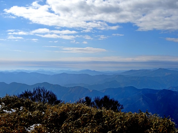
Pretty lovely view of the Pacific Ocean, too.
Next, Fuji-san tried on his Cat-in-the-Hat cowboy hat.
By the way, around here, everyone knows that Fuji-san likes to try on hats like this when he knows it’s going to rain in the evening.
It did rain.
Finally, photo below, a whipped-over-to-the-land-of Oz hat.
Remember, Oz? There was some scary stuff there, all right.
But only when Dorothy’s mind wasn’t in the right place.
The right awareness is easy. Just tap your heels together three times—or take three gliding steps through the “Yuki ga arukiyasui” Aozasa snow.


 Turn your head to the left and there are the southern Alps. Come in mid-April or thereabouts and that bare-branched cherry tree will be sporting pink ribbons and bows. It’ll provide a splendid canopy for a picnic.
 March 9th. It had been a bit warm, but there’d been lots of rain and it was hard to gauge, beforehand, just how cold it remained in the mountains . . . so we Hearty Hikers had thought we might get one more chance to walk across the gentle Aozasa ridge in the snow.
 And when Fuji smiles at you, under a big blue sky, you can’t help but tingle and smile back.
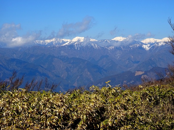
 . . . our own lovely Hearty Hiker, were all smingler and smingled, all at once.
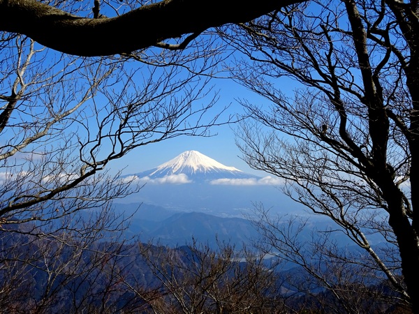 He smingled us from beneath branches big and small.
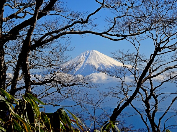 He smingled us through circles of branches.
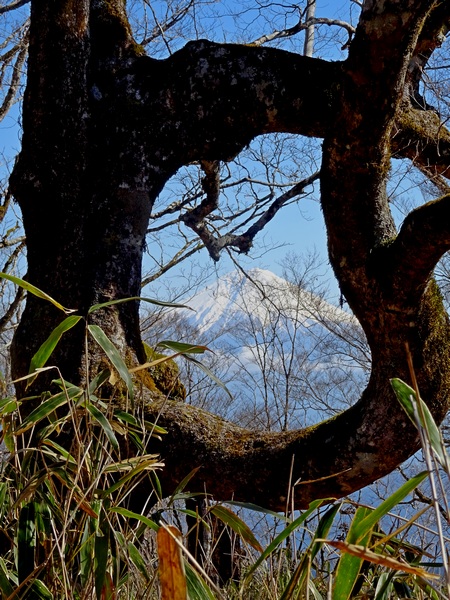 He smingled us through circles of trees!
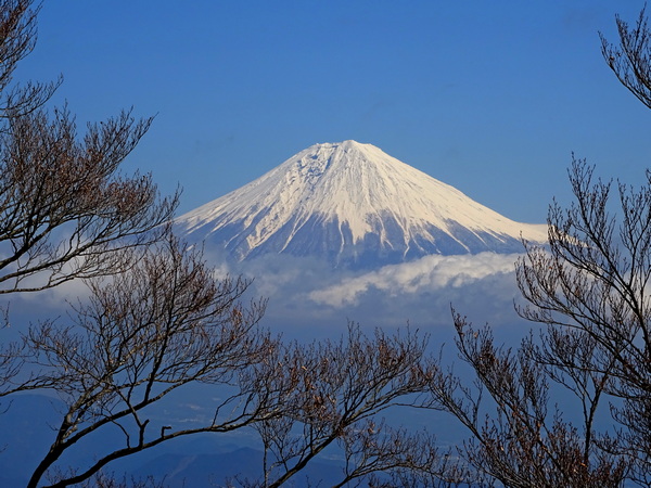 He perched himself high in the sky and smingled us through a winter-branch garland.
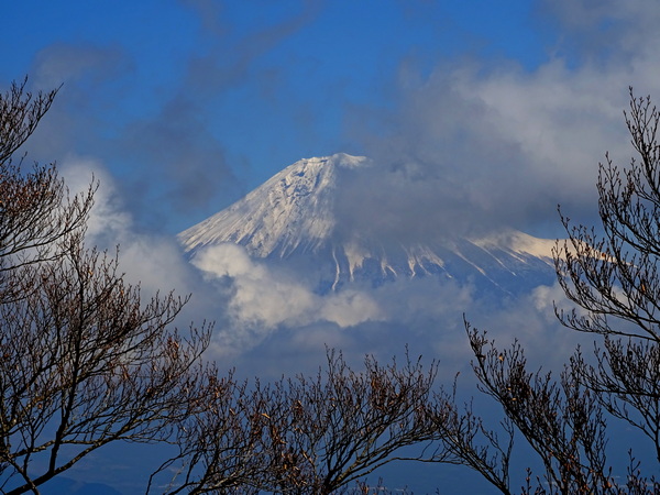
 On a day with so much smingling, you don’t have to think twice about showing a little gratitude. Thank you, Jizo-san.
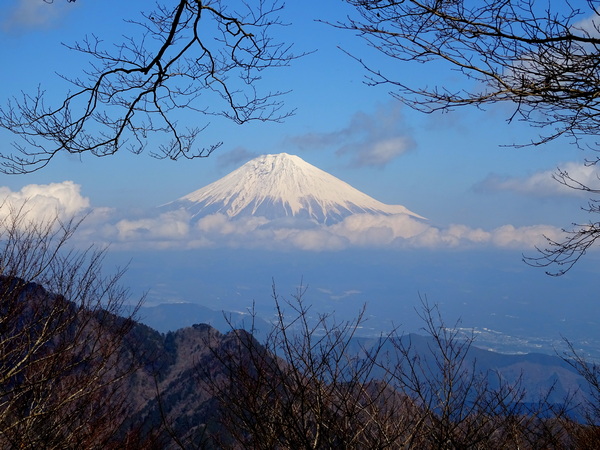
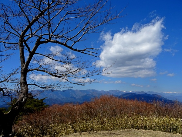
 Greatly beloved of us Hearty Hikers, Ryuso Mountain.
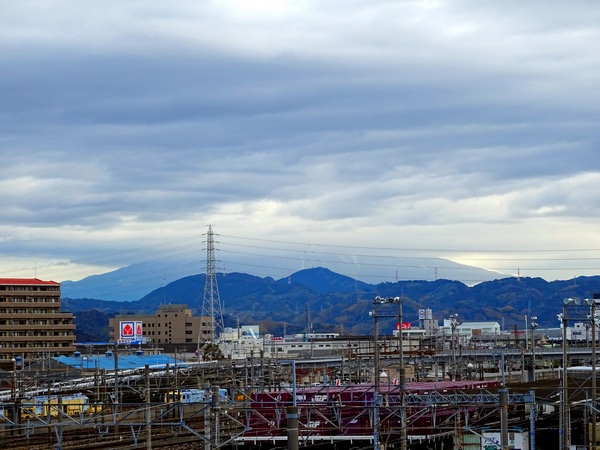
 And when the blue does come out, it’s easy to STOP . . . as in STOP COMPLETELY . . . and enjoy the moment.
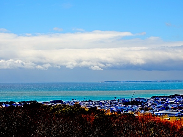
 If you drive six or seven minutes past Aoi Kogen and get to a place where it looks like a couple of cars could park . . . and red-coat Jizo is there to greet you, then you know you’re where you’re supposed to be.
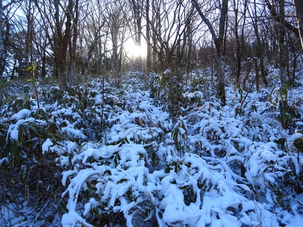
 Reaching the Jizo Pass.
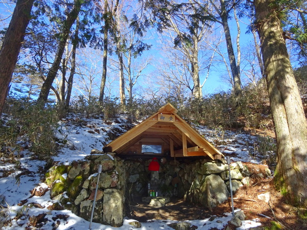
 And of course, you’ll need a bit of time simply to experience pure joy.
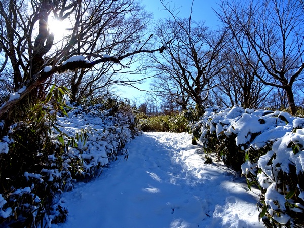 It was, you might recall, a spectacular walk along this trail, walking under this lovely blue sky, gliding (or so it seemed) through this sweet snow—a couple of years ago—that inspired our musical friends, NDuaDuo, to compose their song, “Yuki ga arukiyasui,” which, I guess, translates literally as “It’s Easy to Walk in the Snow,” but perhaps translates, in terms of meaning, more effectively as “What Joy it is to Walk in the Snow.”
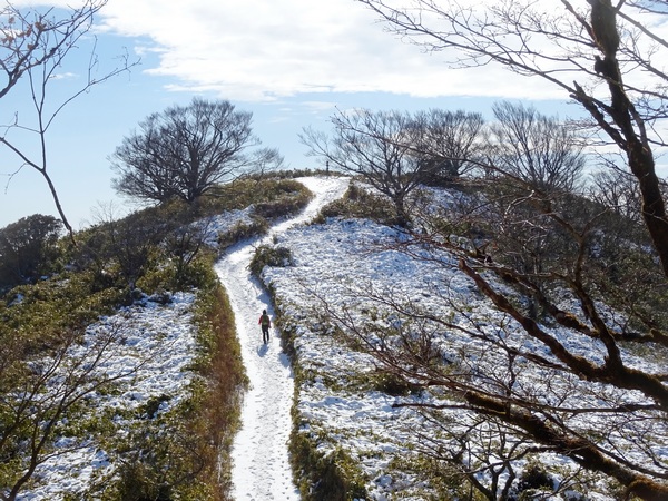 The final ascent to the Aozasa summit.